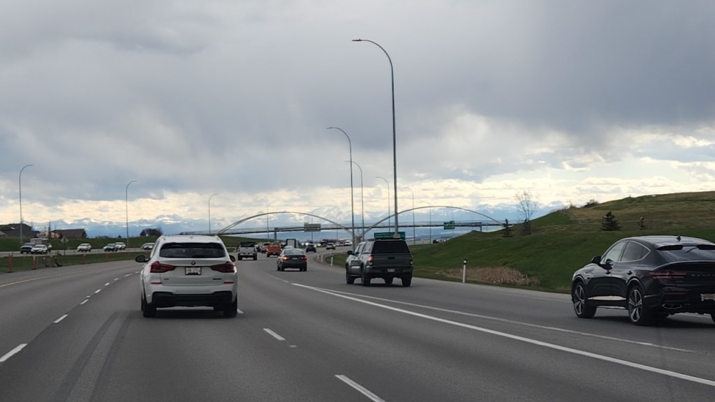
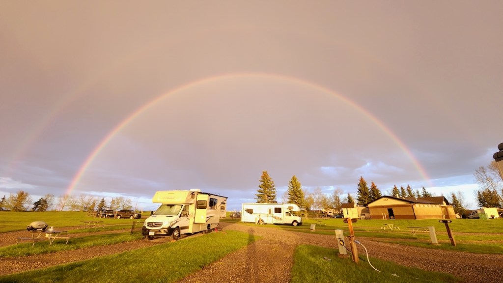
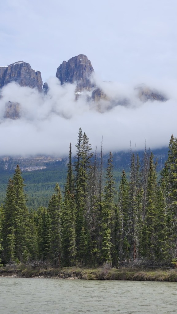
On Friday, May 22 we picked up a car at the airport as we were driving to Calgary. That meant we were driving separately so I only managed this one photo as we went around a corner and there were the Canadian Rockies – still 90 miles away, but snow covered and impressive. That evening there was a thunder storm, and the sun came out in time to get a fantastic double rainbow!
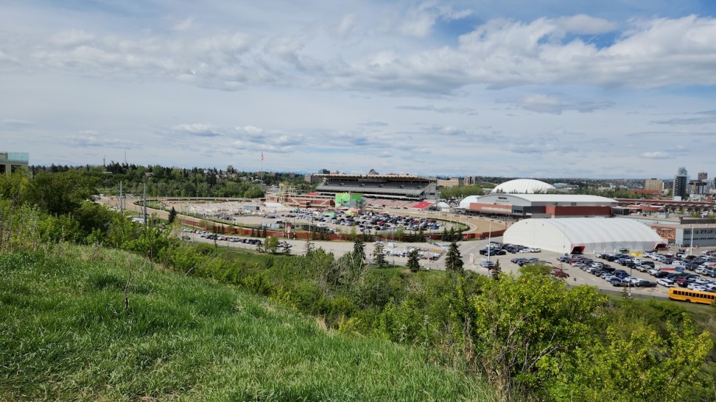
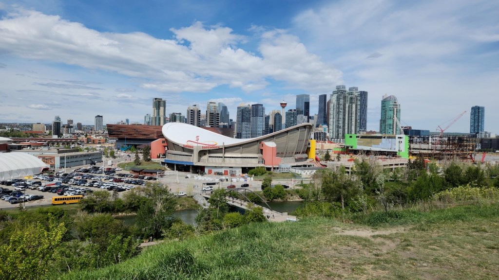
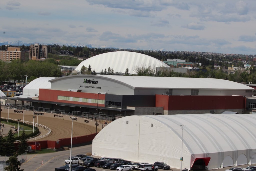
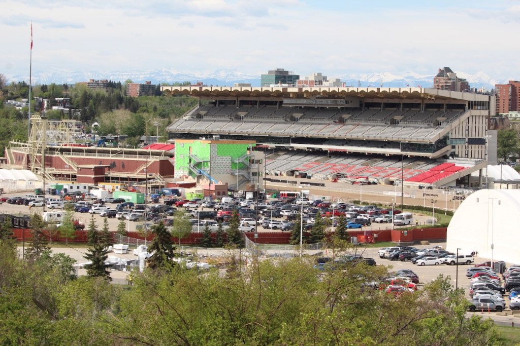
We started our day on Saturday by going to Scotsman’s Hill. It is a great overlook to see the Calgary Stampede Grounds. Guess which building is called the Saddledome.
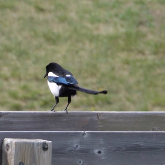
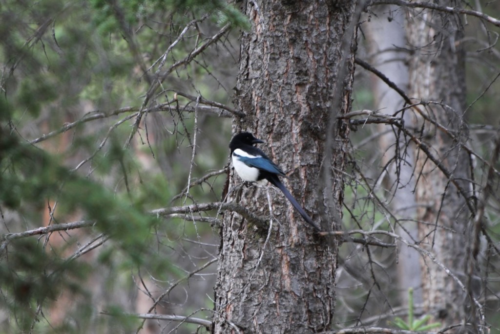
A magpie – you don’t realize they have the blue on them unless you catch them in the right light.
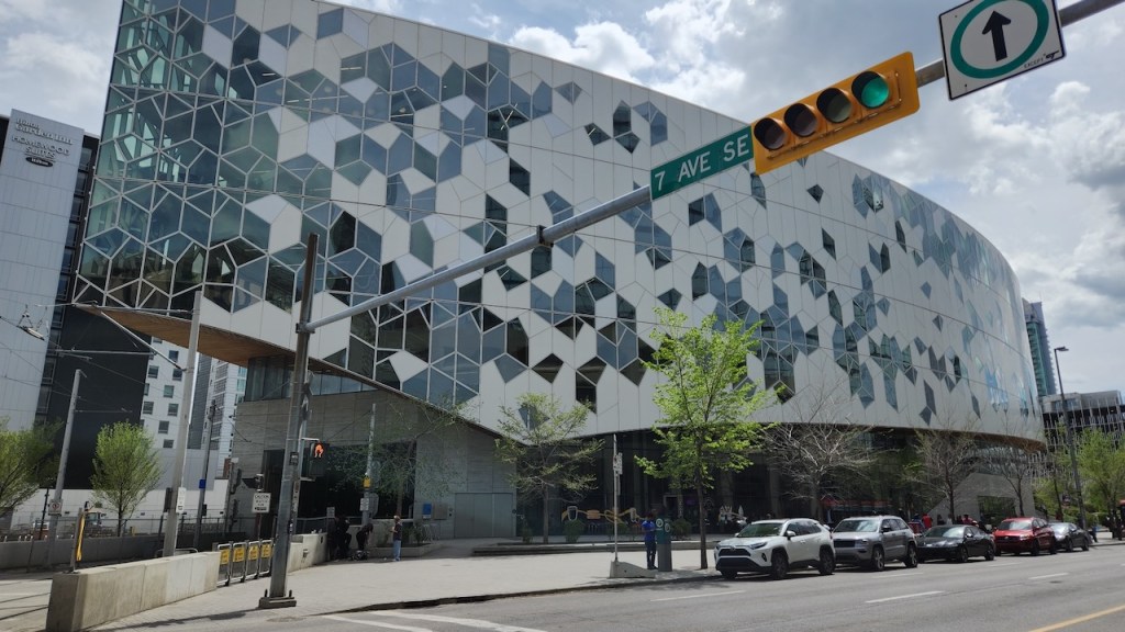
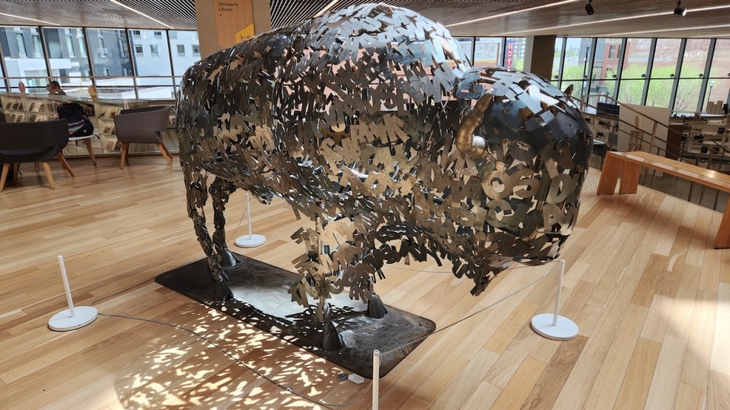
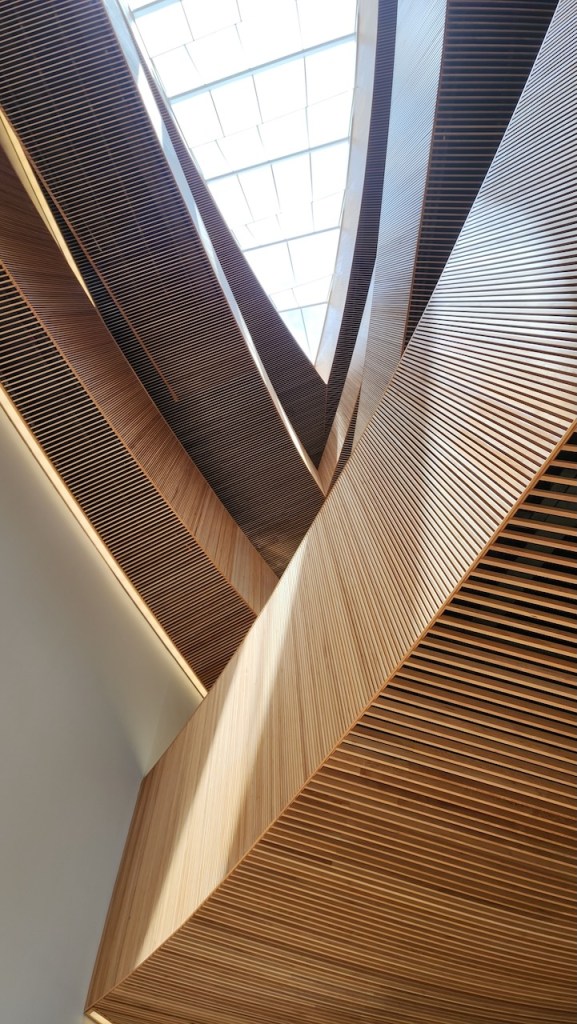
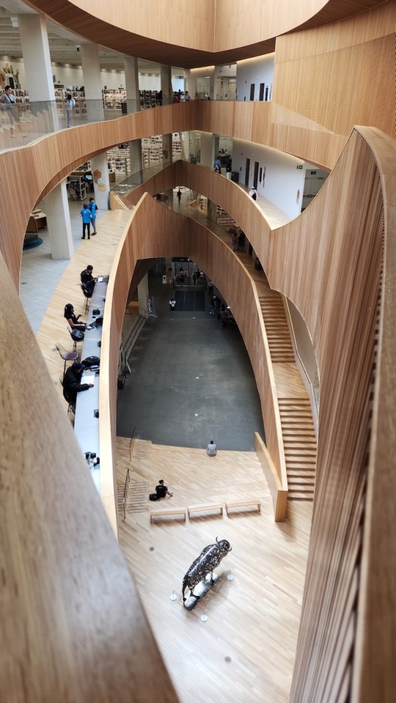
We had heard that the Calgary Library was amazing – well, they were right! Looks kinda like an Escher print on the outside, but the architecture inside is the crazy part. There are five stories, it has this cool tear drop like atria and there is a coffee shop IN the library. The “Education is the New Buffalo” statue was made out of steel letters welded together.
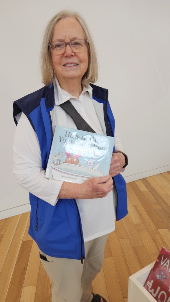
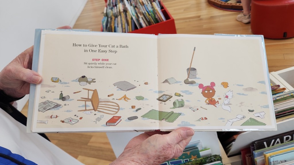
The library had the biggest children’s room I have ever seen, and on a Saturday afternoon it was being well used. Not sure if you can read the title of this book – it’s “How to give your cat a bath”. We had to read it – the first page stated “How to give your cat a bath in five easy steps.” It was all a disaster, which you can see on the last page of the book.
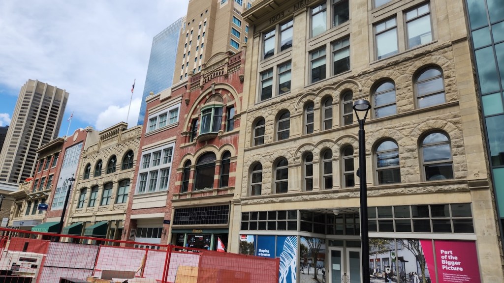
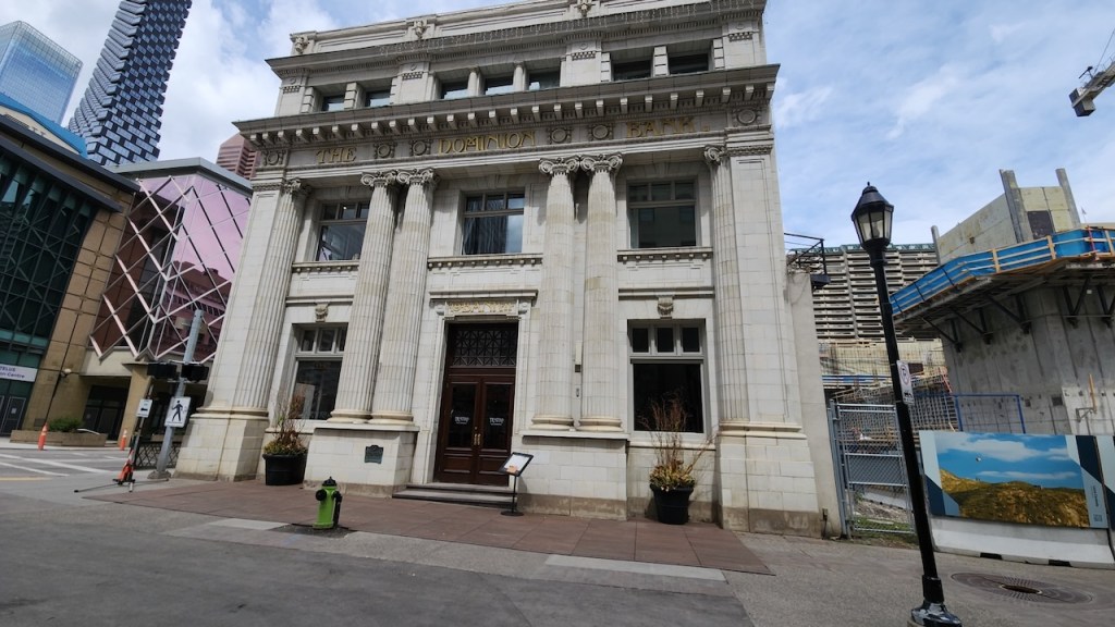
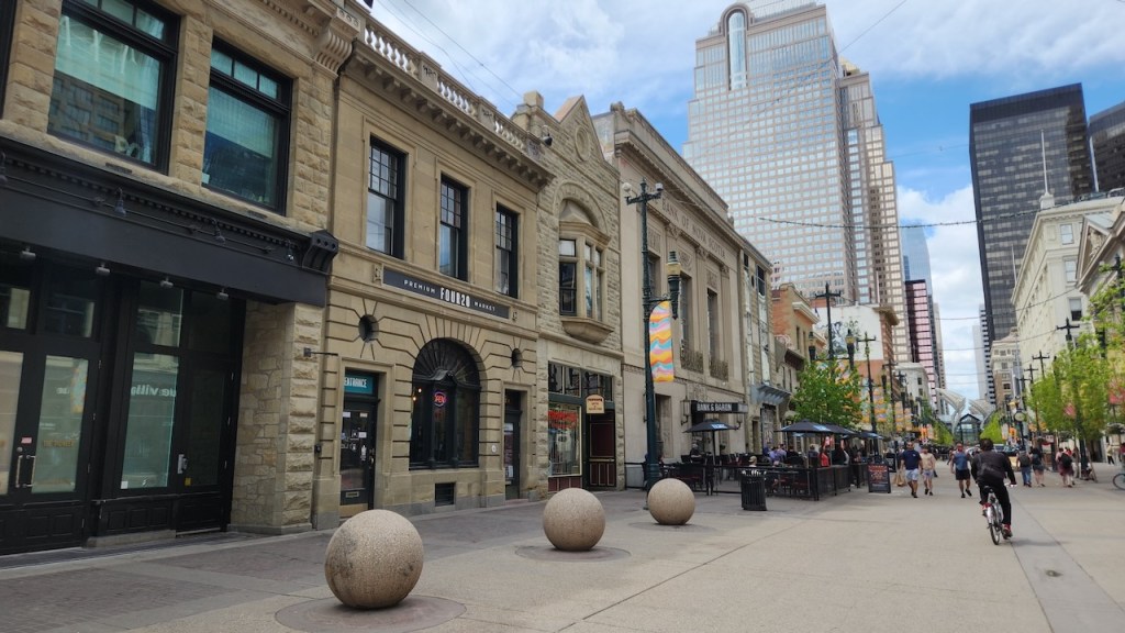
We then walked over to Stephen Avenue – it is the heart of the historic district in Calgary. Calgary was on the railroad line and is similar to the other planned towns and cities along the route. The buildings of Stephen Avenue were built between 1880 to 1920 and are representative of the architecture of their time, featuring Victorian, Art Deco and Beaux-Arts elements.
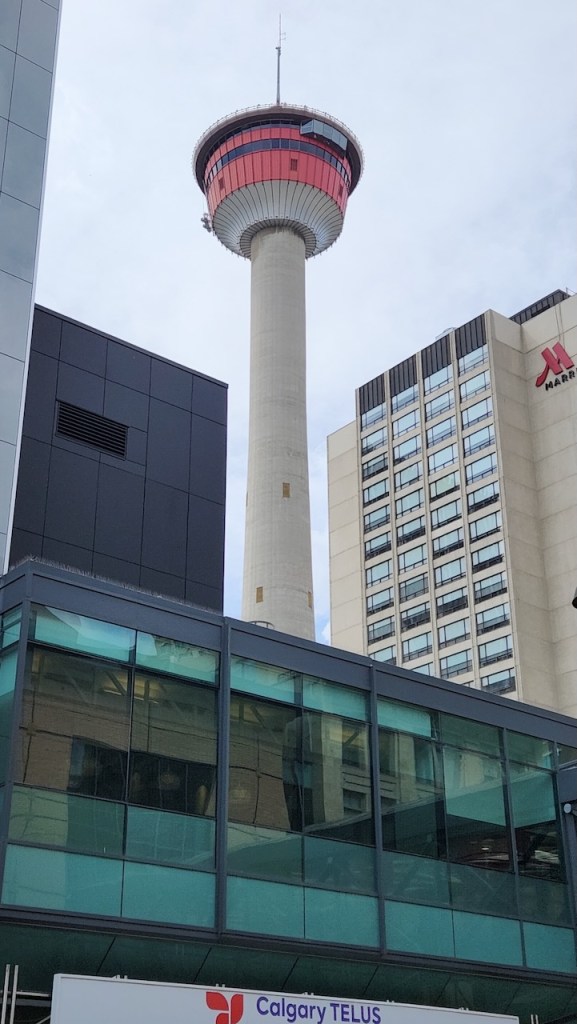
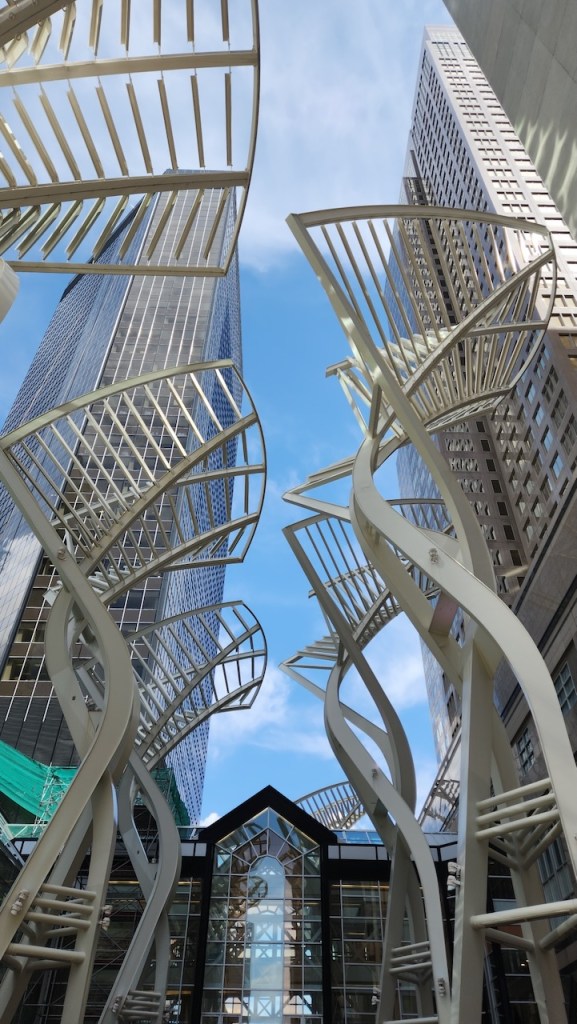
This is Calgary Tower – since we had seen the city from Scotsman’s Hill, we didn’t need another view. And this modern sculpture was at the end of Stephen Avenue.
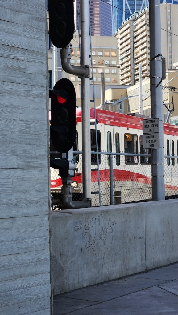
After getting some lunch, we road the train back to the library – the train goes right under the library – though the stop is before so we didn’t get to go under (if we had we would have had to pay for the ride.)
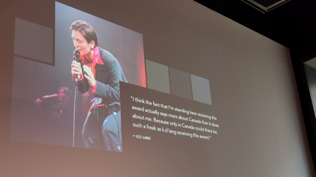
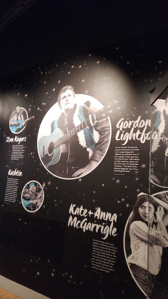
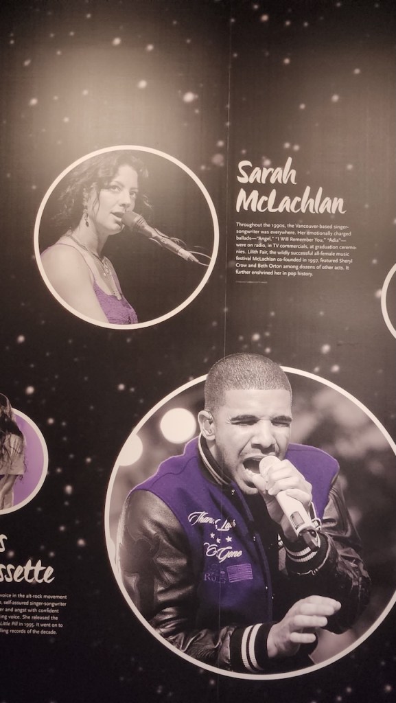
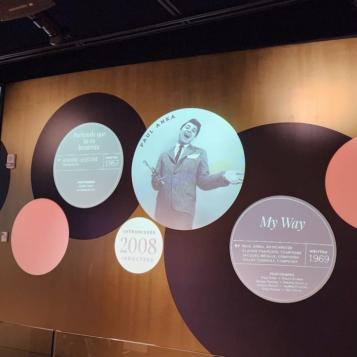
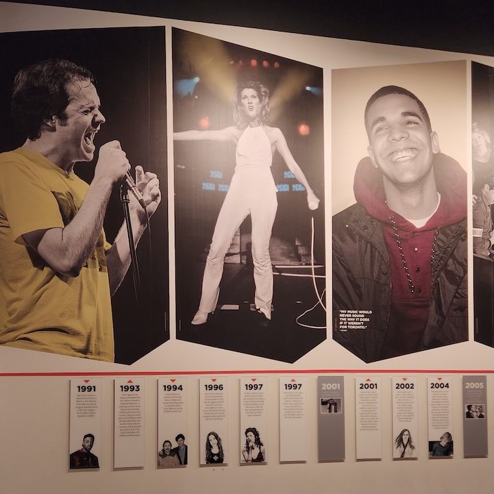
We then walked over to Studio Bell, which is the National Music Center and the home of the Canadian Music Hall of Fame, Canadian Songwriters Hall of Fame, Quebec’s Adisq Hall of Fame, and the Canadian Country Music Hall of Fame. Even with all that fame, it is still a smaller version of the Rock & Roll Hall of Fame in Cleveland. Some of the artists honored, that we recognized, are below.
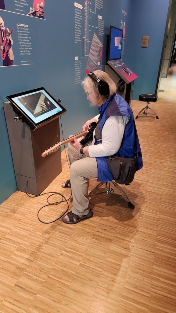
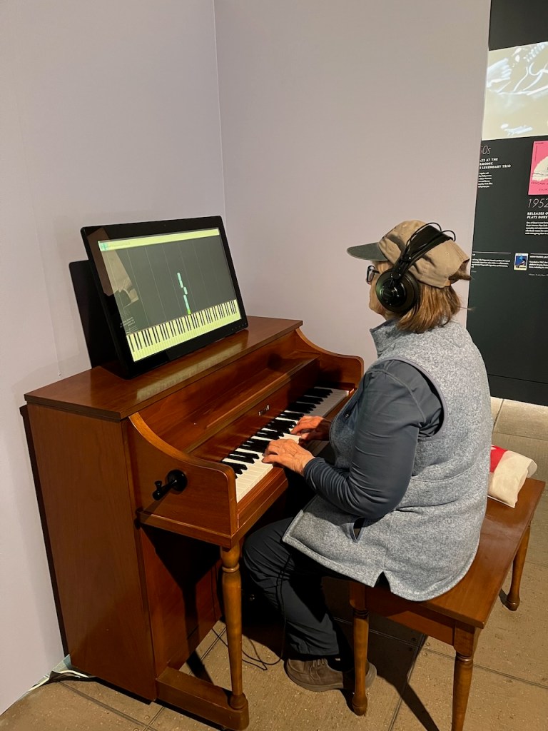
Trying out some of the instruments.
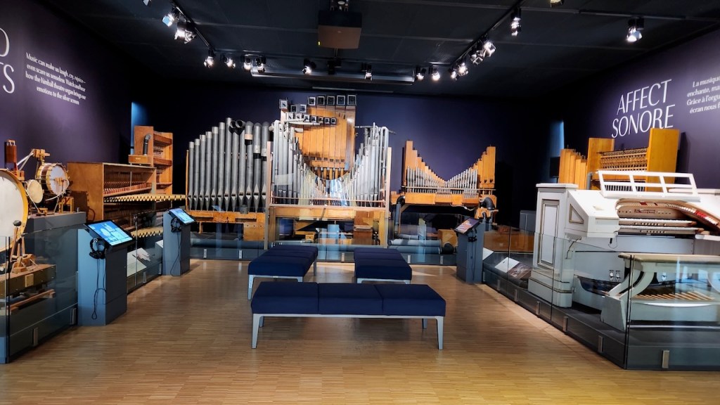
This organ was built in 1924 by Chicago’s Kimball Piano and Organ Company and was first installed in St. Helens Theatre in Chehalis, Washington. After being in a flood, being restored, moved to another theatre and then a church, it was donated to the Cantos Music Foundation (precursor to the National Music Centre) in 1999. Didn’t get to hear it play live, but did hear some recordings.
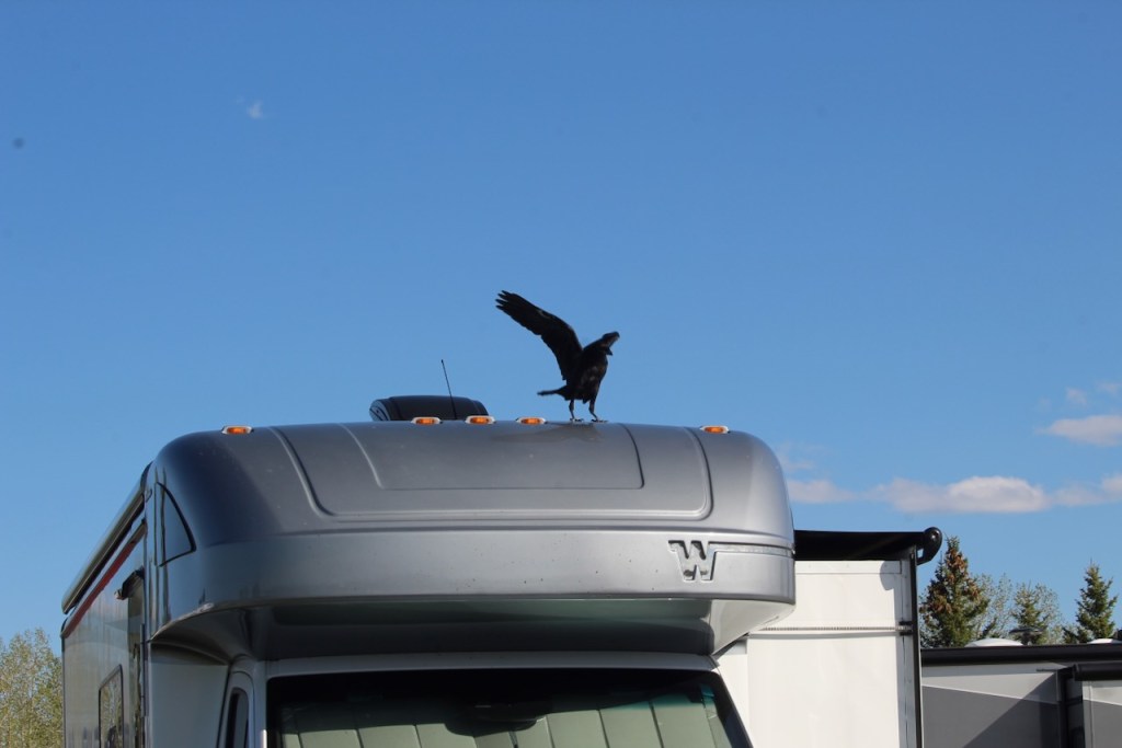
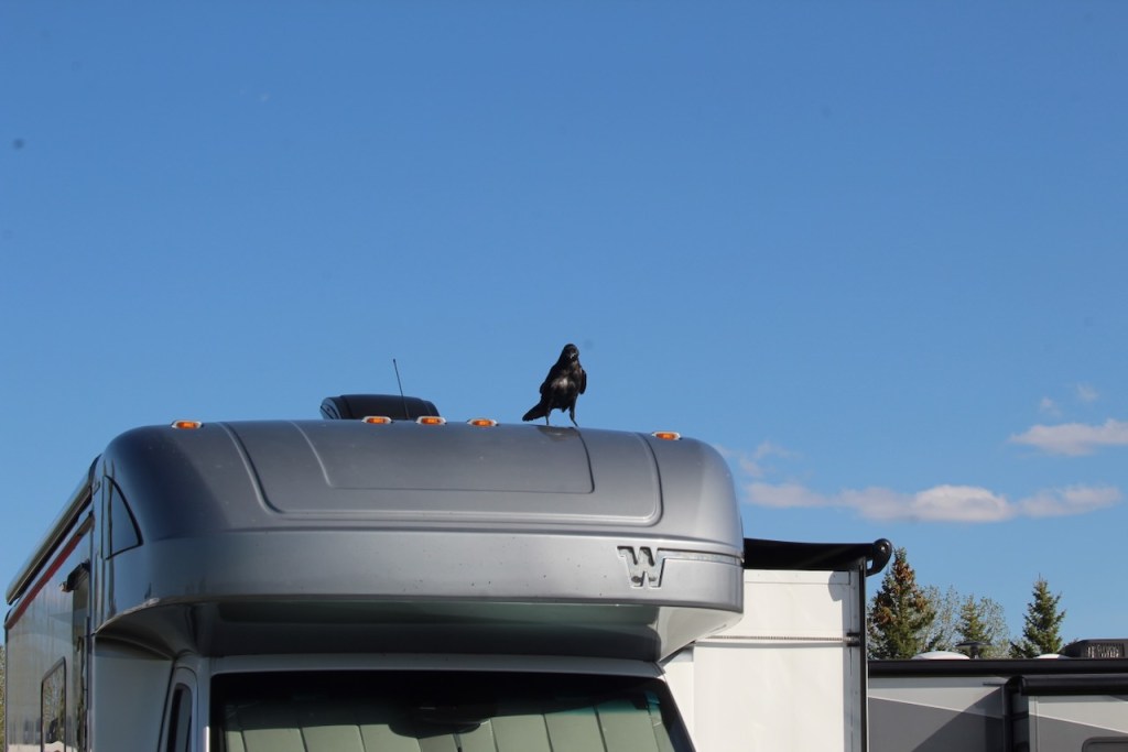
Later that evening we were sitting in the RV wondering what that noise was on the roof – I went out to take a look. Not sure why the crows had decided to dance around on our RV.
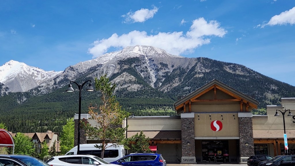
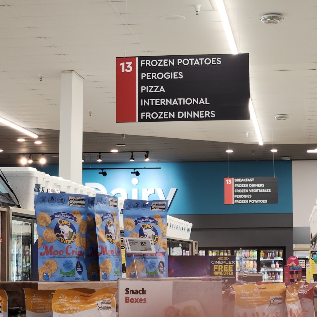
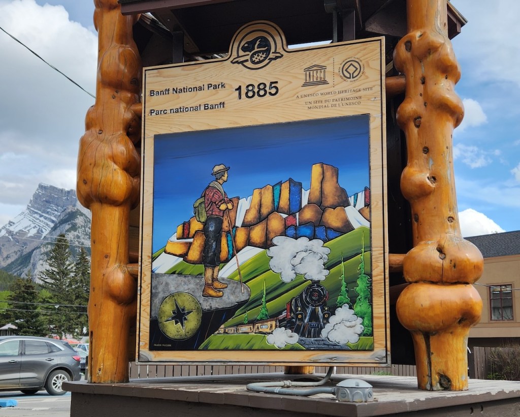
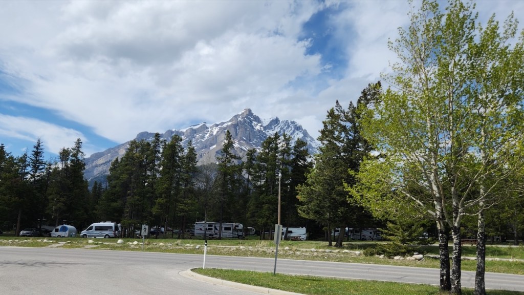
On Sunday, we stopped in a grocery store in Canmore, AB on the way to Banff. There was a great view of the mountain from the parking lot. Had to take a photo of this sign, as I had never before seen pirogies on an aisle sign in a grocery store.
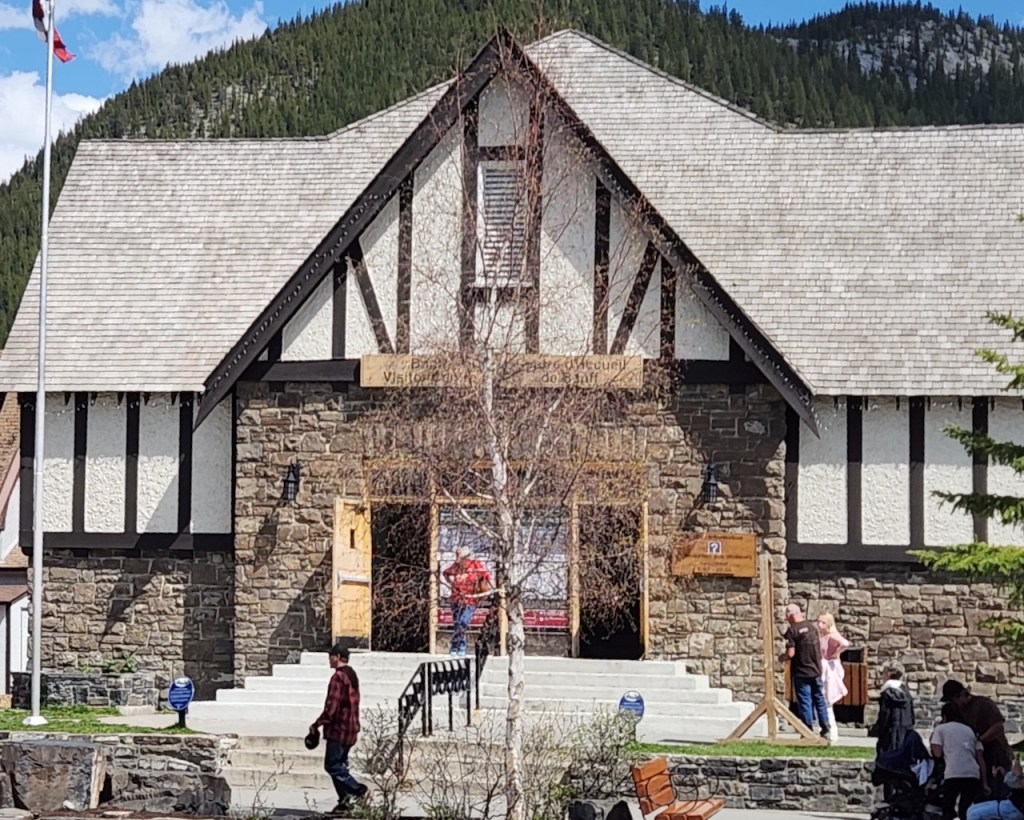
After getting set-up at our campsite for the night, we drove into town and found the visitor center for the park. Got a couple of good ideas for some easy walks and places to go.
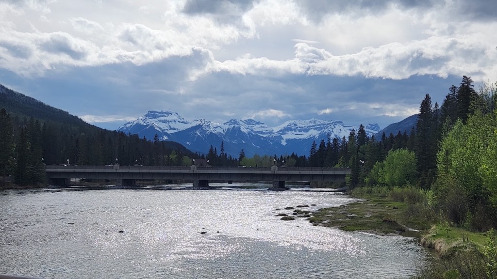
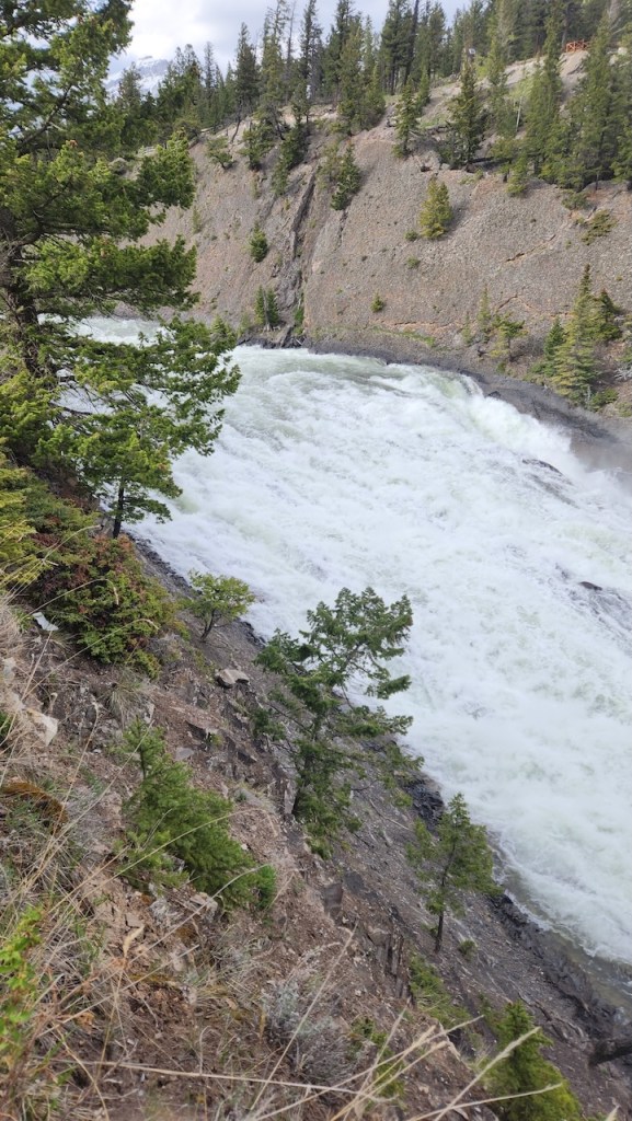
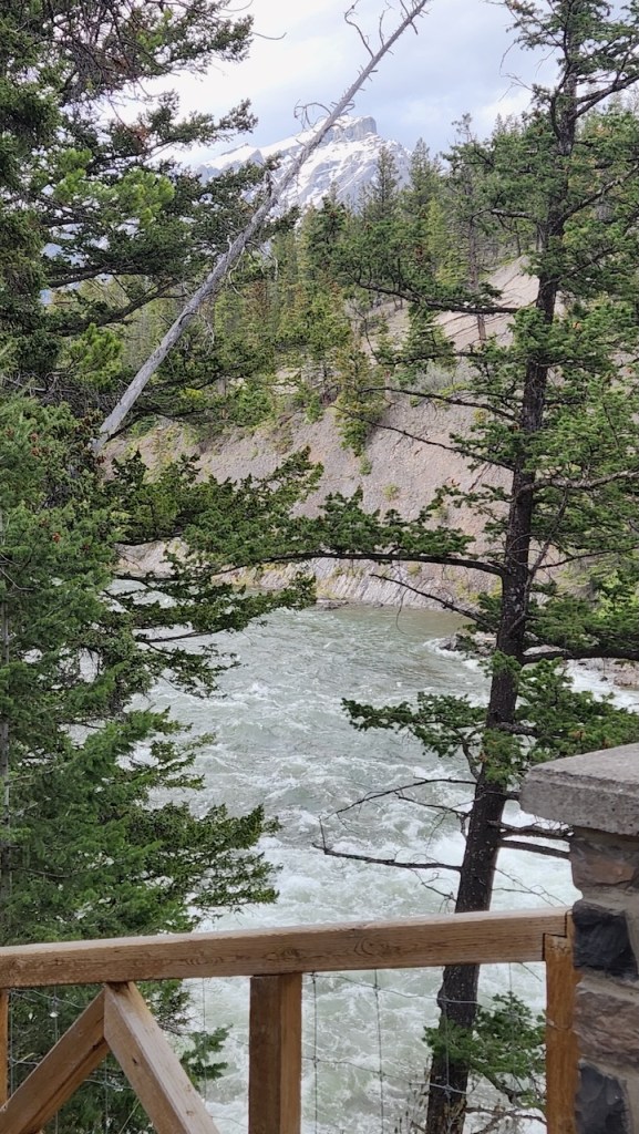
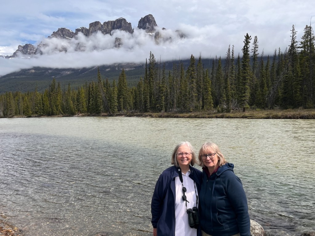
We wandered down the Main Street – Banff Avenue and then took the walk that led to the Bow Falls. It was a little longer walk than we anticipated, and I didn’t bring the water along, so we took it slow. The walk went past some nice houses and then followed the Bow River. We were not impressed by the “falls” – from where we were viewing, they just looked like some rapids.
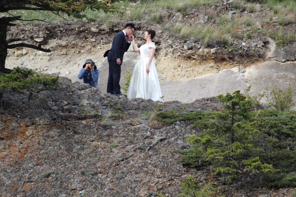
But we did look up to the opposite bank to see this photo shoot occurring.
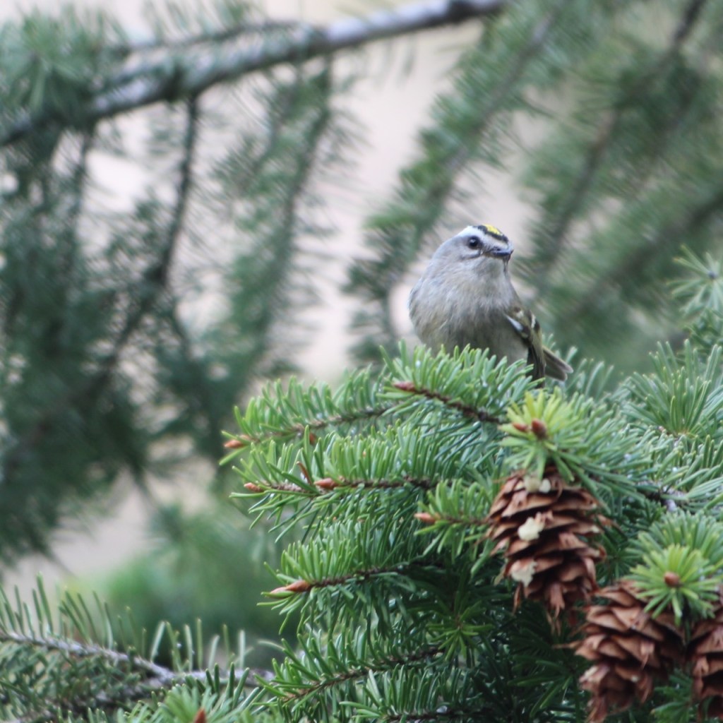
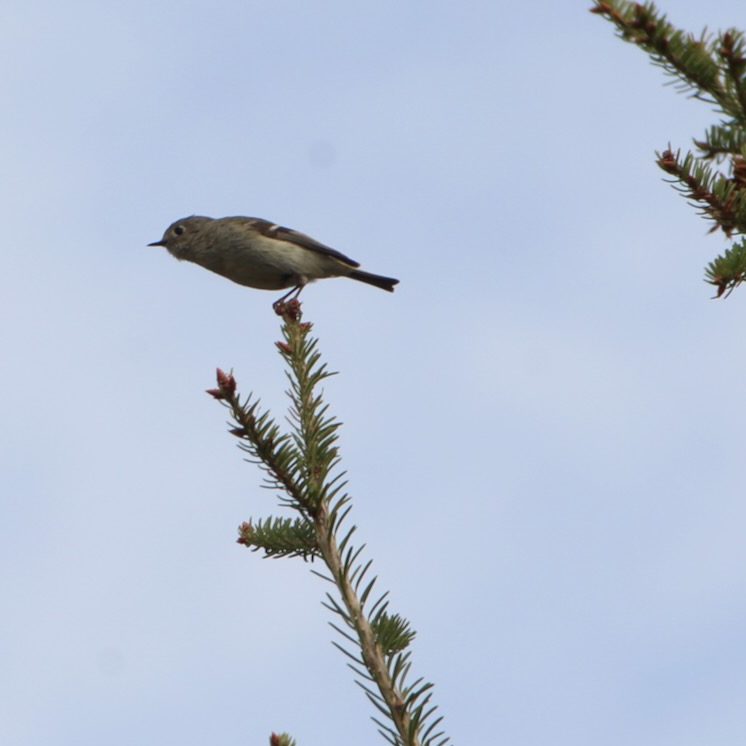
And we saw more magpies and a golden crowned kinglet.
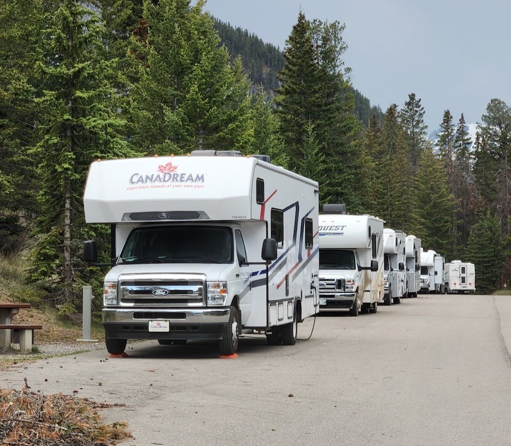
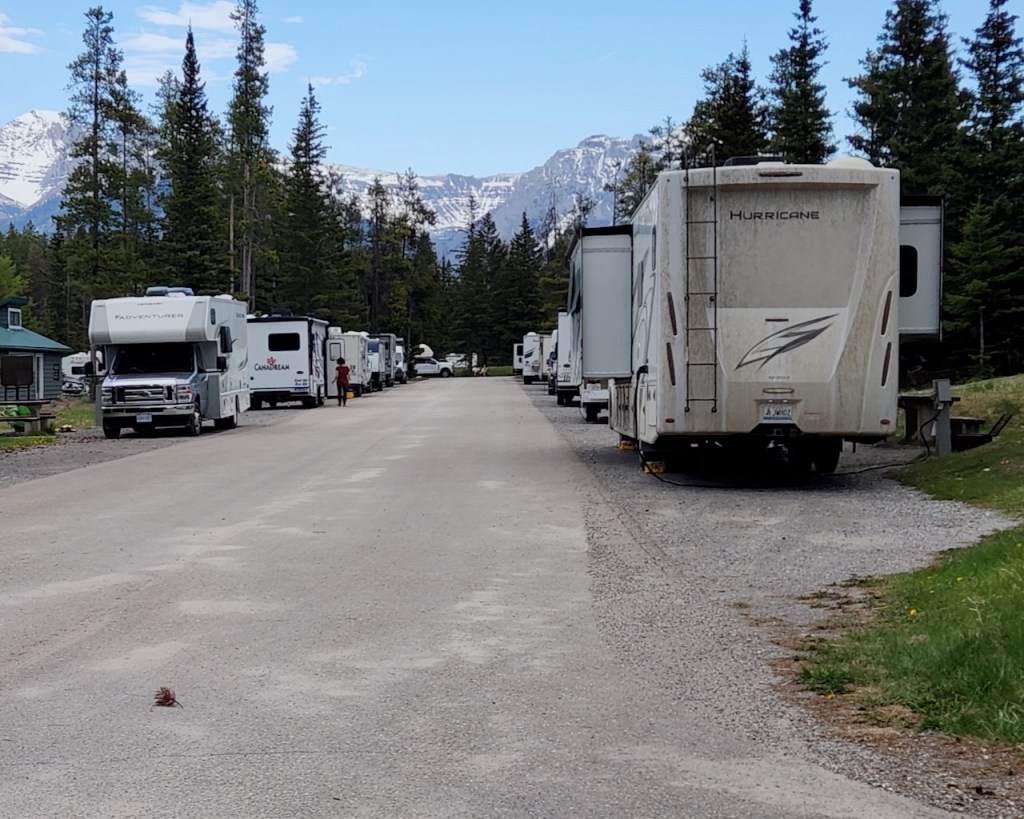
When we drove back to the campground, we checked out the spot we were supposed to move to on Monday, for the rest of our stay. Well, as you can see from the pictures below, that spot was not very inviting. Basically you had to parallel park along the road, and only had a very small patch of grass for your picnic table. So, while Trish fixed dinner, I worked with one of the rangers to find a spot that would work better for us. We were able to move after dinner and got set up for the rest of our stay. I didn’t get a picture of our actual new site, but this one I took from across the road looking at our part of campground will give you an idea. The site was much more hospitable, with the RV actually parked in a spot about 10 feet off the road and you felt like you were among the trees, not in a parking lot.
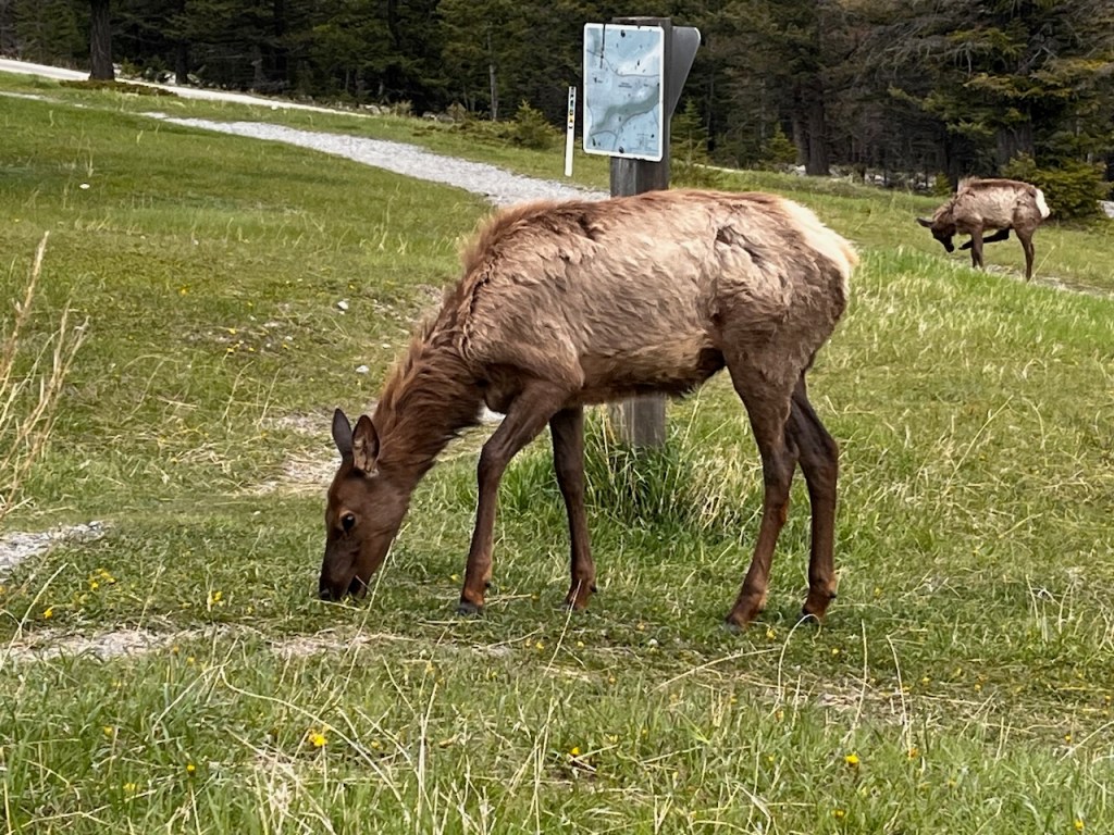
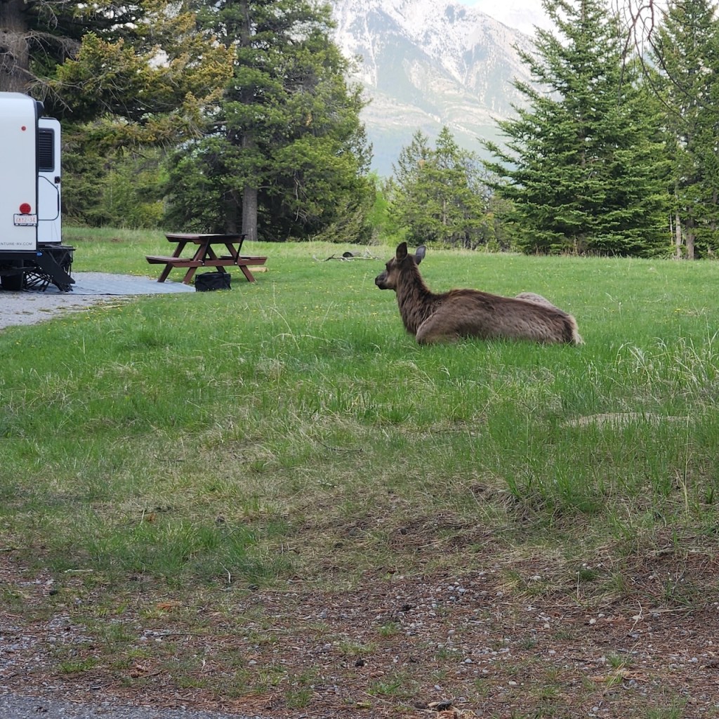
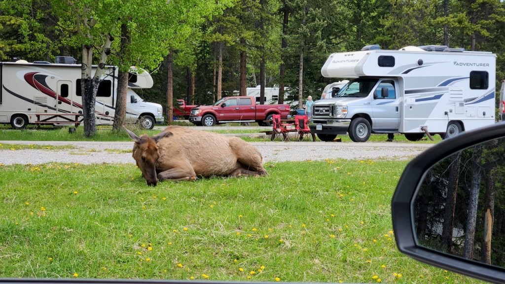
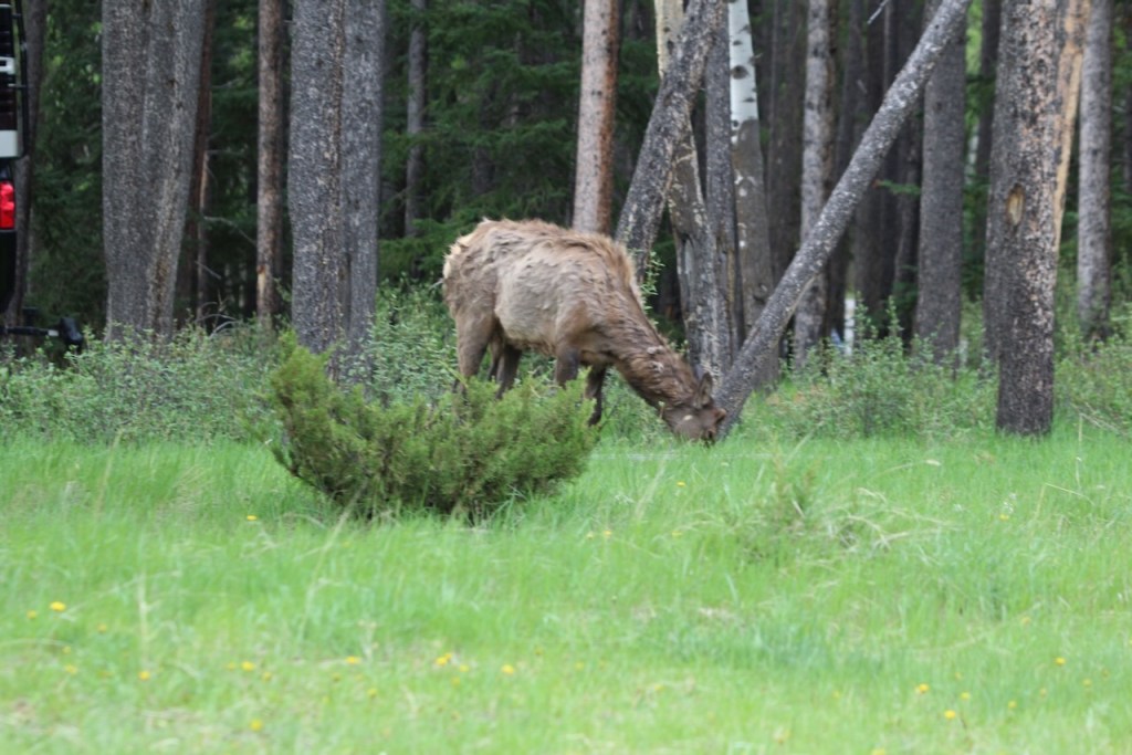
These are some of the elk that we saw every evening when we returned to the campground.
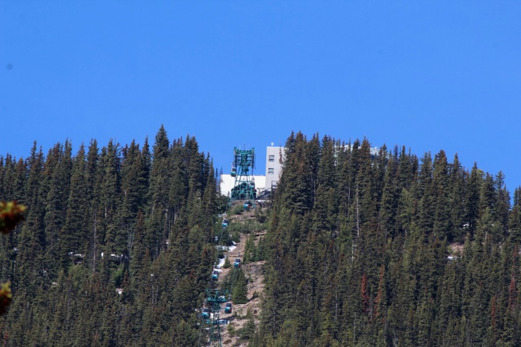
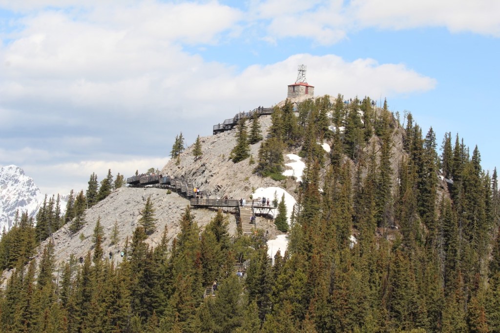
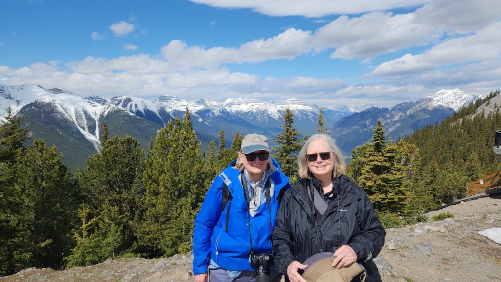
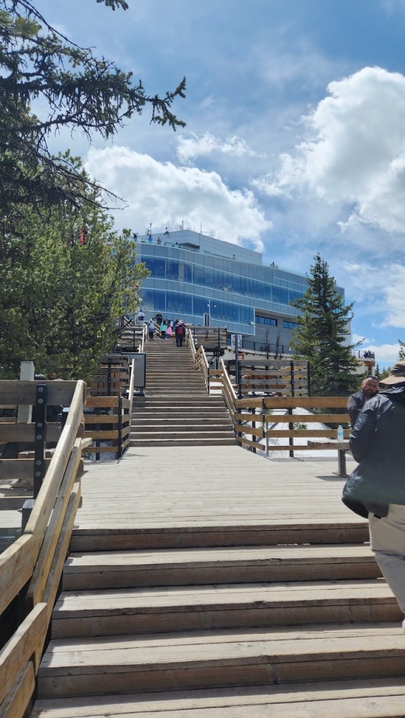
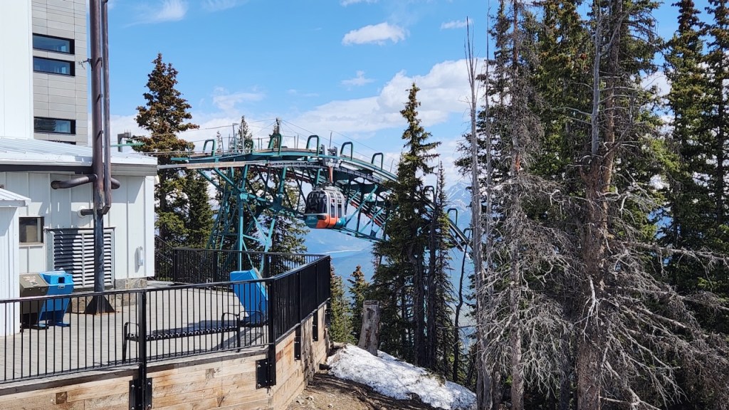
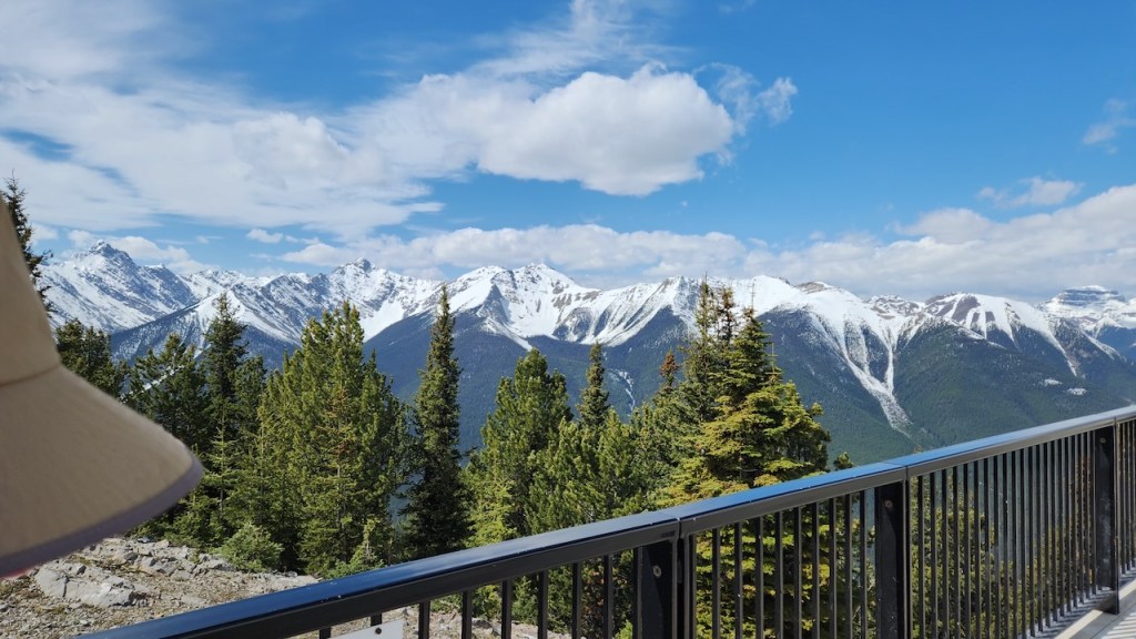
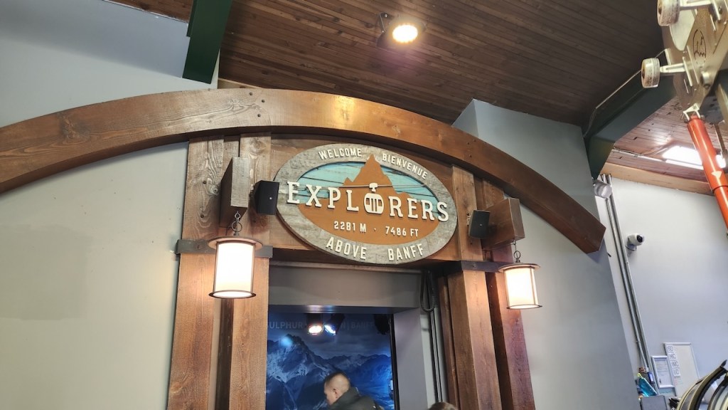
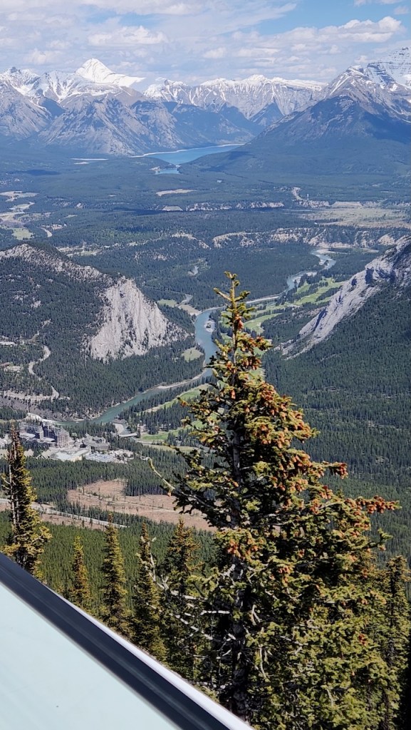
On Monday we had a reservation for the Banff Gondola. Everything we read said that parking would be scarce, so we parked at the free lot in town and rode the bus to the gondola station – the ride was free with our pre-paid ticket. It was one of the smoothest gondolas we have ridden – rising 2,292 feet in 8 minutes to get you to the observation building on Sulphur Mountain. Here we are getting close to the top.
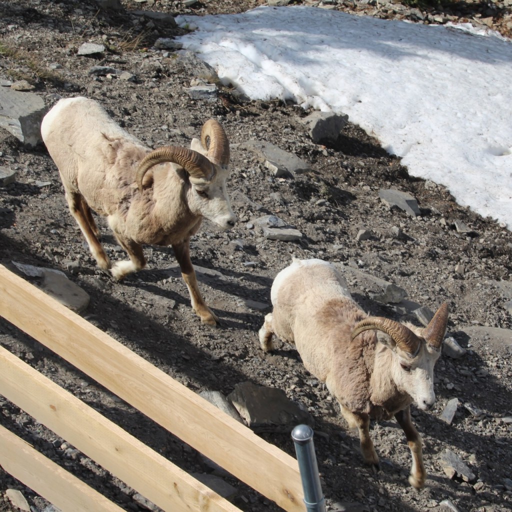
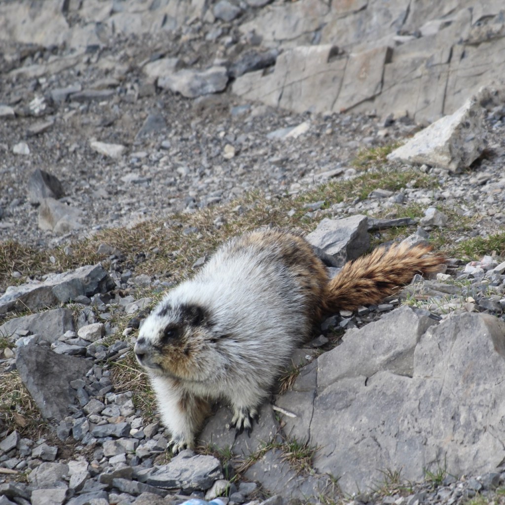
Once we got to the top, we looked down off the building and saw 5 or 6 Big Horn Sheep and this white furry animal. Google lens tells me it is a Hoary Marmot.
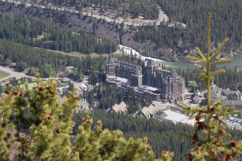
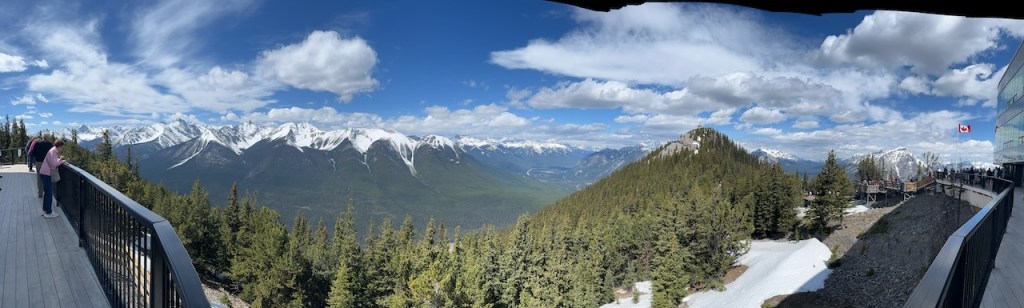
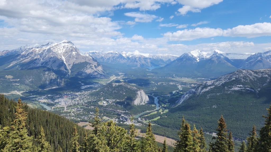
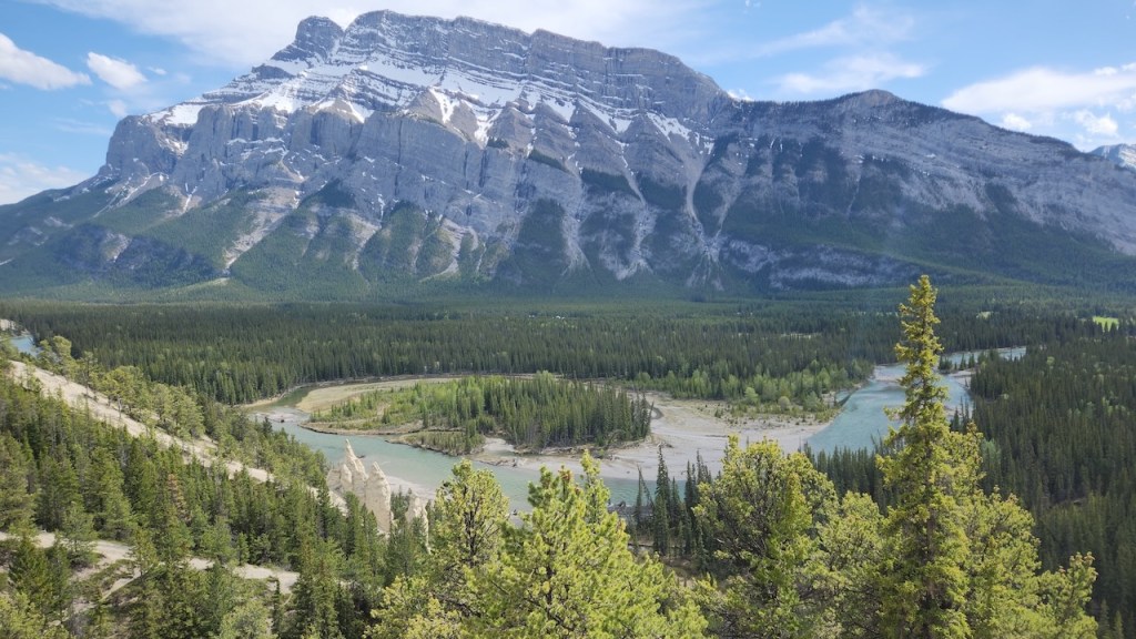
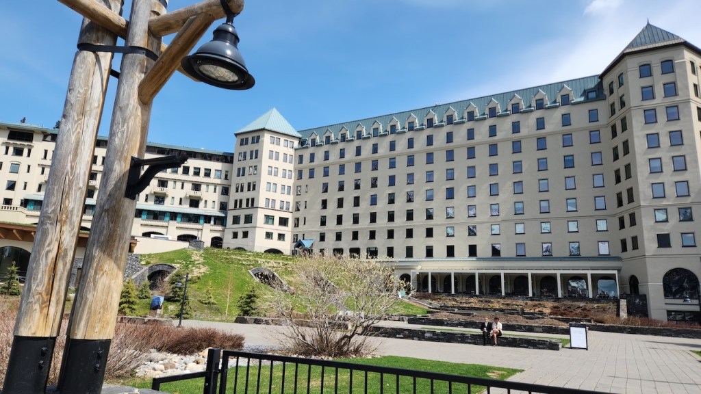
Looking across to the actual summit of Sulphur Mountain and down on the Fairmont Hotel.
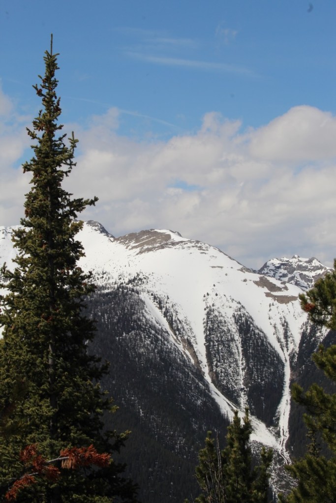
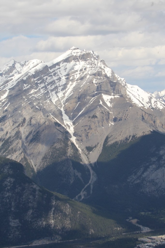
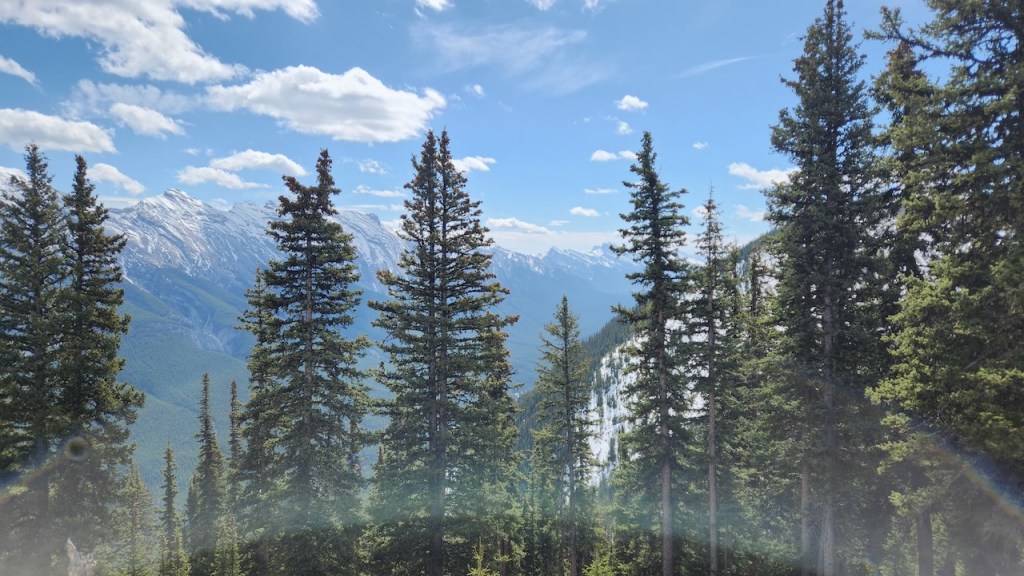
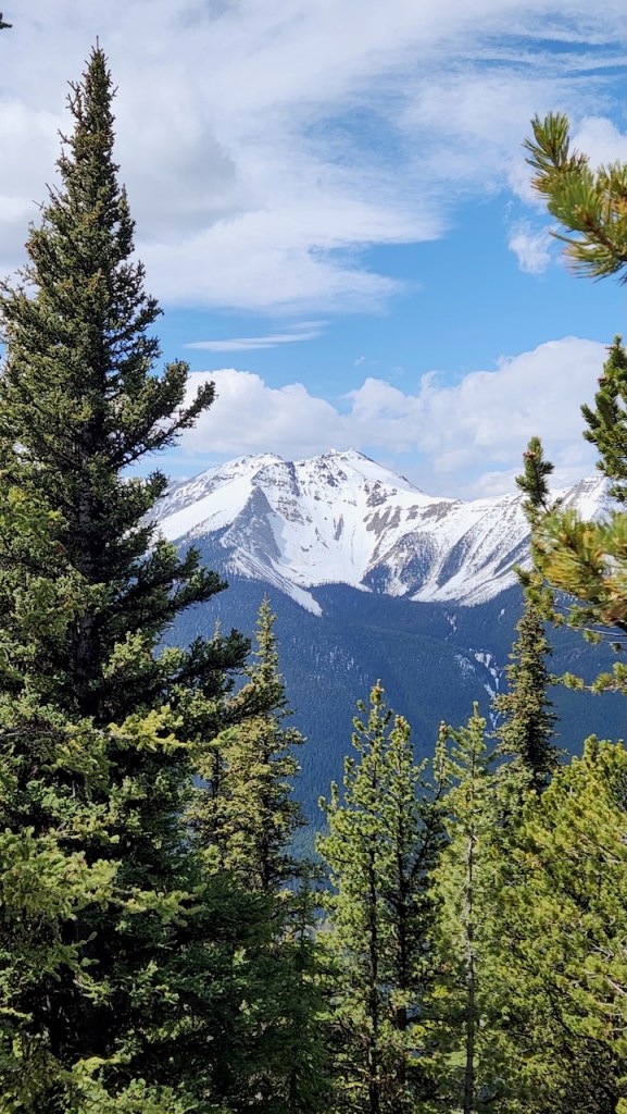
Every where you looked there were mountains and more mountains, all of them still snow capped.
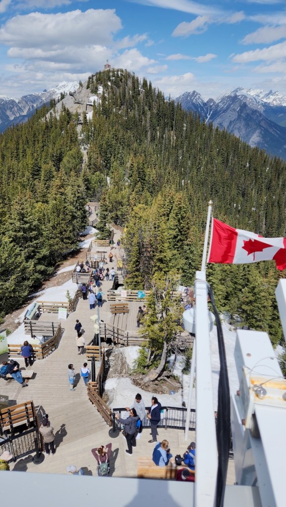
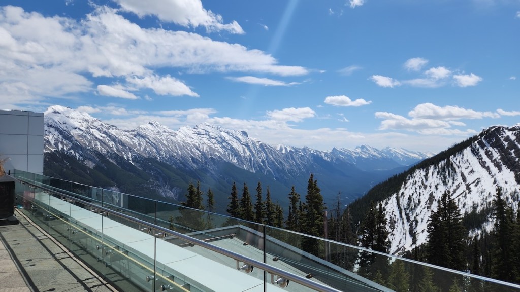
This is a better view of the trail that leads over to the summit – it’s just over half a mile, but with all the steps, we decided that the views would not be that much better – we did go down some steps to get a feel for it and looked back at the observation building.
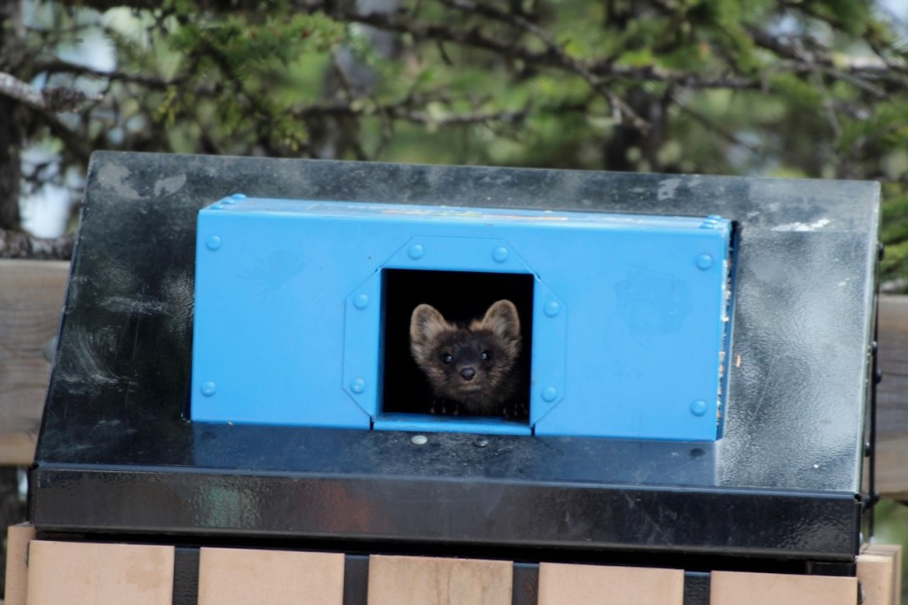
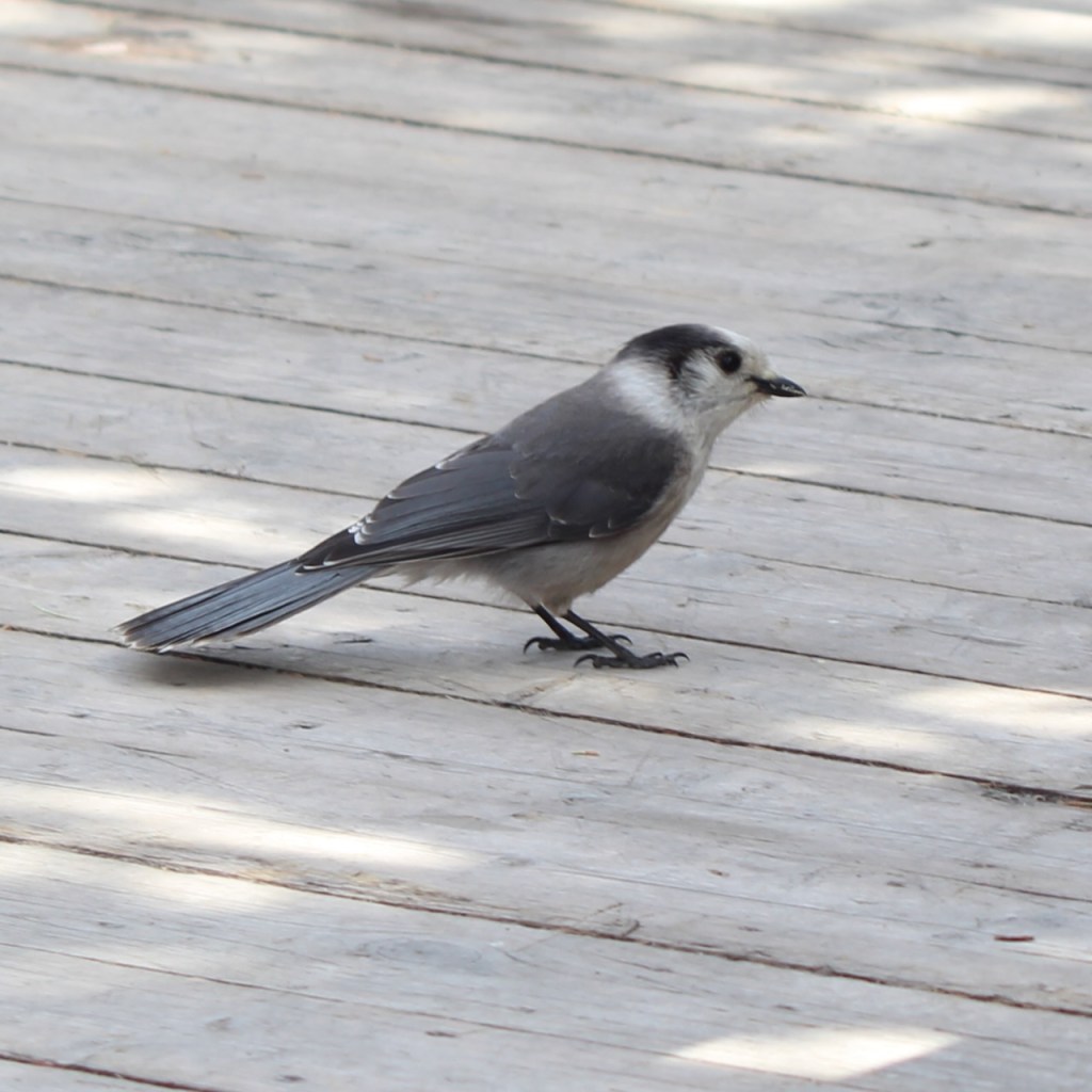
At one of the landings, we saw some folks looking at a recycle container and we heard some noise coming from it – turns out there was a Pine Marten in there. Every once in a while it would stick its head up and see too many people, so it would go back to rummaging around. And this Canada Jay was also hopping around looking for food.
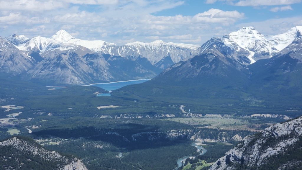
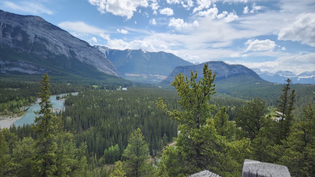
Just have to give you a few more mountain and valley views.
When we went into the building and up to the observation floor, as we got off the elevator they offered us marshmallows to roast. We took advantage of this, but didn’t have the fixings to turn it into a s’more – still good though. We then discovered they had a film, so we extended our time the summit and watched the movie about the park through the years and seasons.
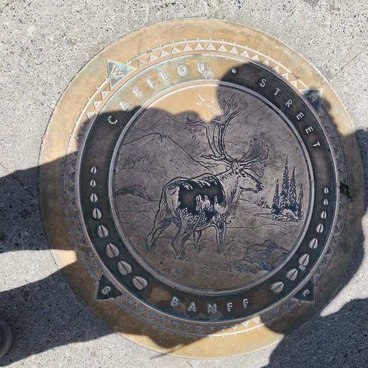
Then it was back to town for some lunch. All the streets – except Banff Avenue – are named for animals. In addition to Caribou St, there were Wolf, Elk, Moose, Muskrat, Beaver, Squirrel and Buffalo Streets, among others.
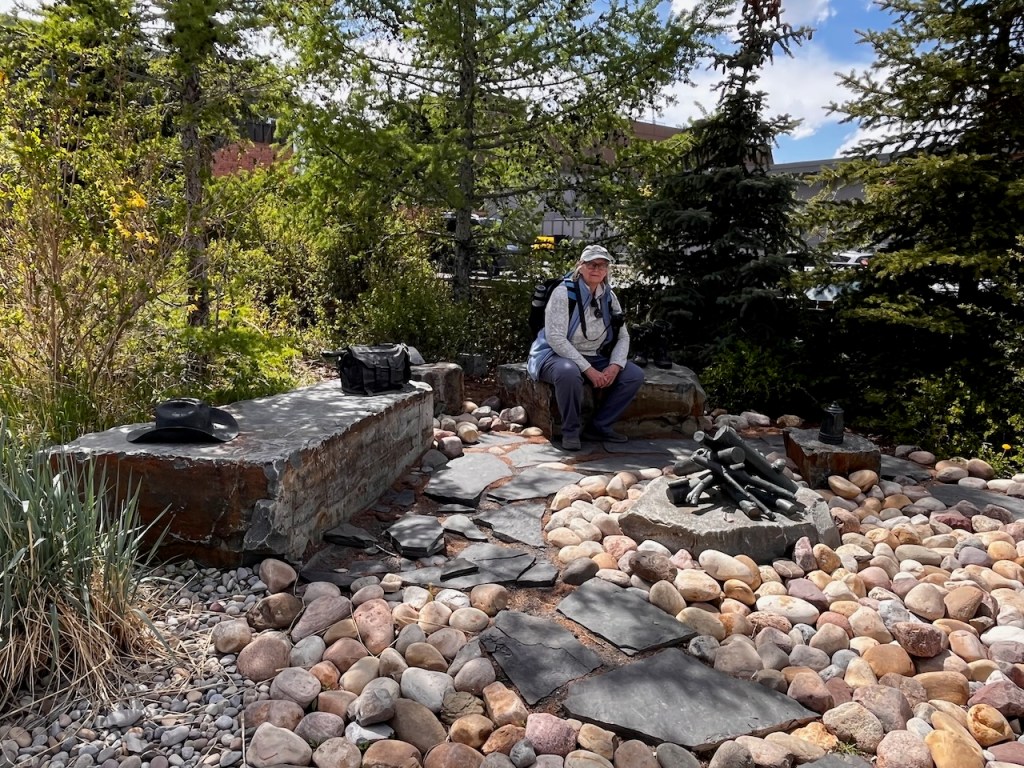
Trish had seen this little sculpture garden, basically an around the fire scene, when we were waiting for the bus, so when we were back in town we had to get my picture taken.
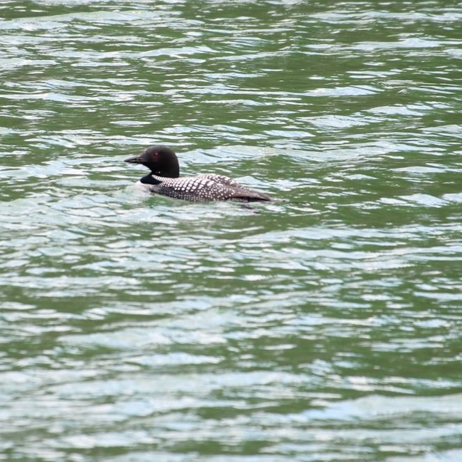
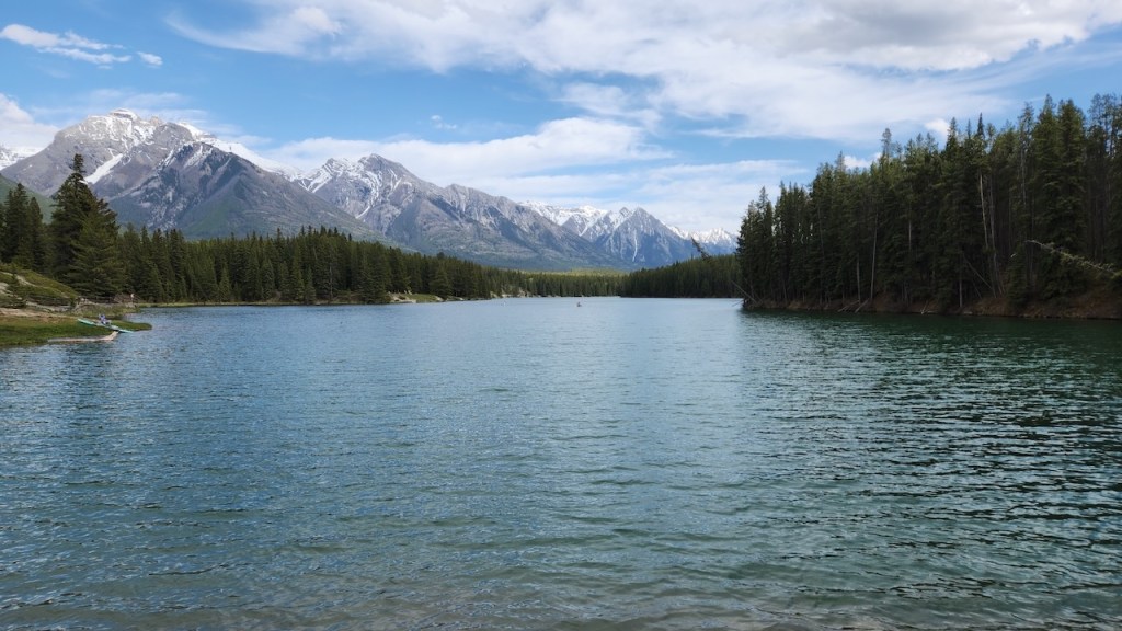
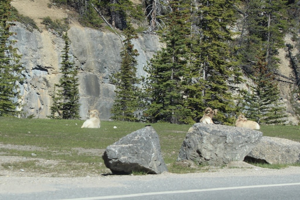
We then took a drive around Banff – went to Two Jack Lack and Lake Minnetonka. At our various stops, we saw a Loon, another Ruby-crowned Kinglet and a Big Horn Sheep.

This is Two Jack Lake – it’s named after two “Jacks.” The first was Jack Stanley, who operated a boat concession on Lake Minnewanka, and the second was Jack Watters, who worked at the mines nearby.
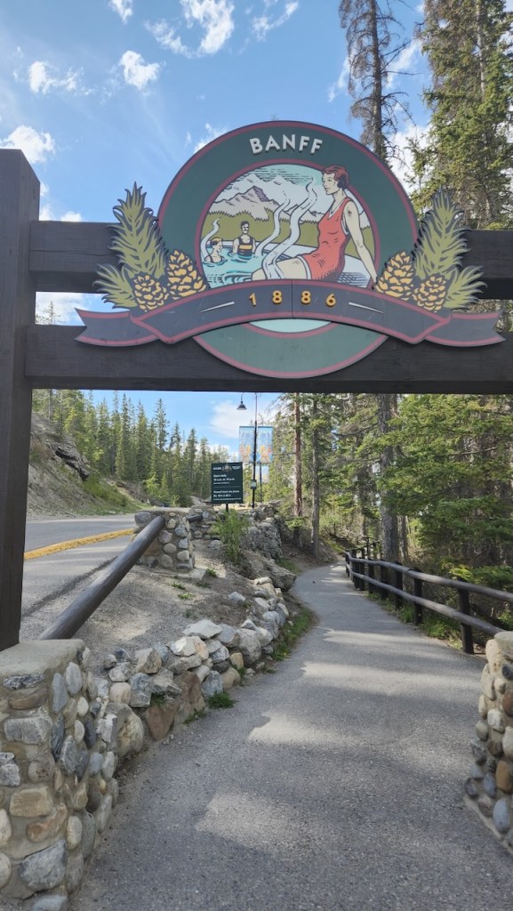
After our drive, we went to the Banff Hot Springs – yes, they were back on Sulphur Mountain – but despite the name, I didn’t think the water really smelled that bad. There was one big pool at 104 F and we enjoyed soaking for about an hour. The last picture below is the spring that started the hot springs – we didn’t get that close to see how hot it was coming out of the ground.
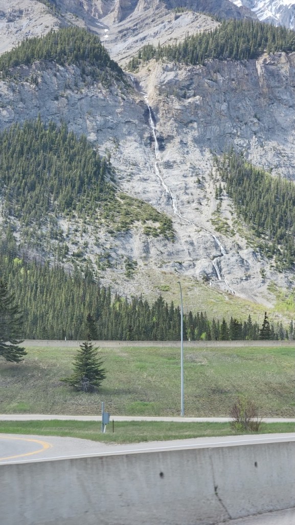
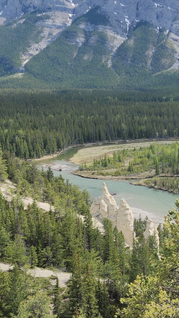
Another thing you see, at least at the time of the year that we were there – water falls are flowing in many places. There was a spot on the way to the campground that was a short walk out to some hoodoos. Well, it was no Bryce Canyon Amphitheater of hoodoos – just a few lonely outcroppings.
Back at camp – another elk settling in for the evening.
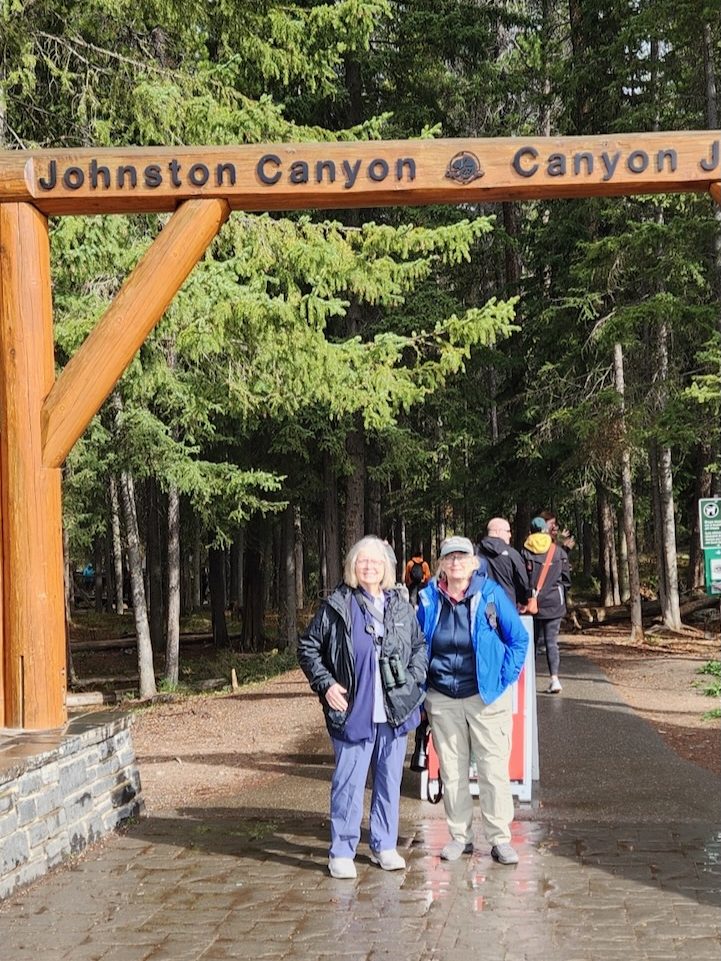
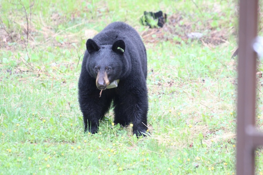
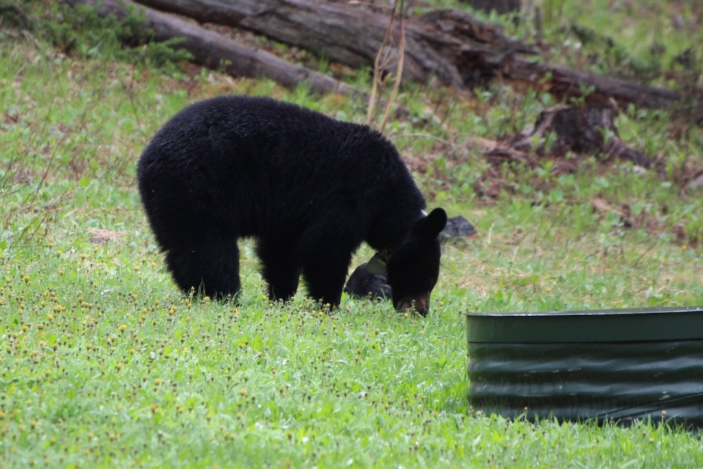
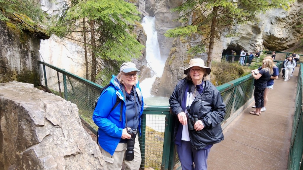
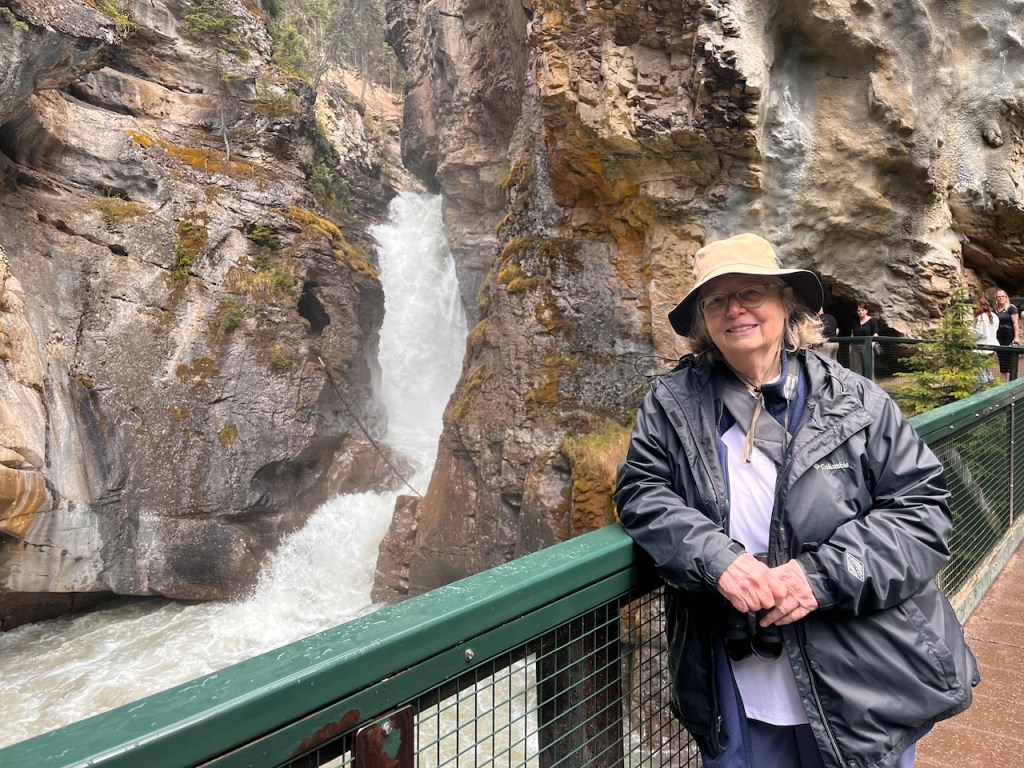
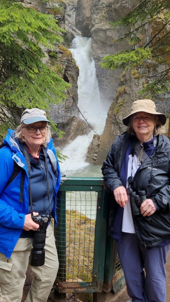
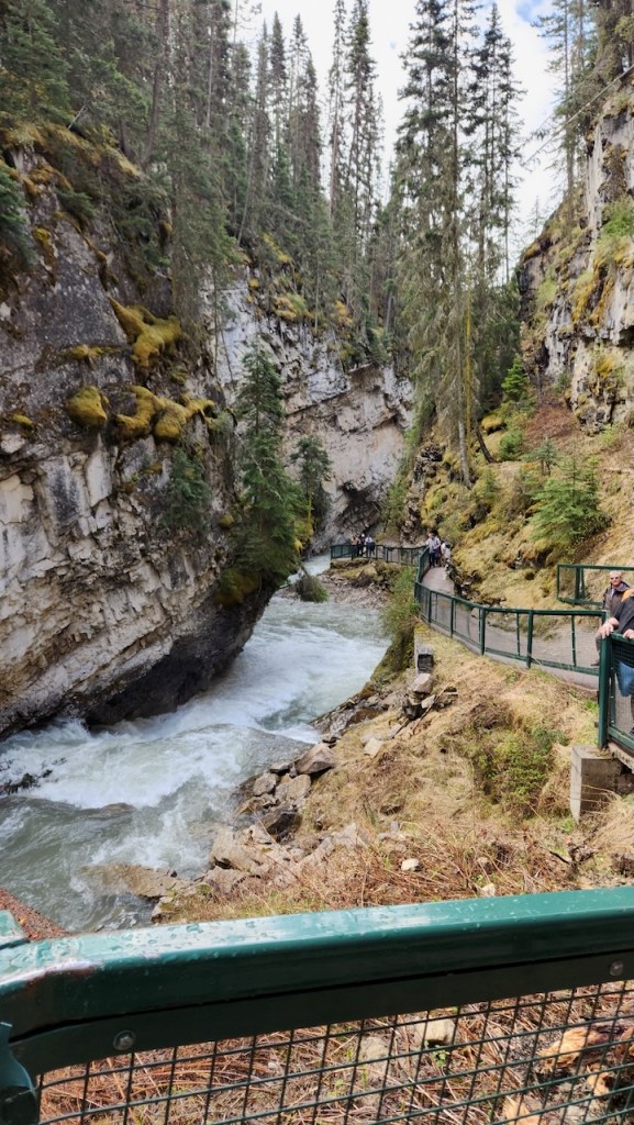
On Tuesday, we were signed up for a tour of Banff. It left from one of the hotels in town and was in a 12 passenger van, so not overwhelming with people. The weather was iffy so we had our layers, including our rain jackets. Our first stop was Johnston Canyon – where we took a walk/hike along the river to the lower falls. But the first thing we were greeted by when we stepped off the van, was a young black bear eating grass near the bathrooms, about 25 feet away from the sidewalk. Needless to say, some folks were getting too close, and our guide had the trigger guard off his bear spray, but the bear seemed to be content to continue his grazing. We didn’t see him when we got back to the parking lot.
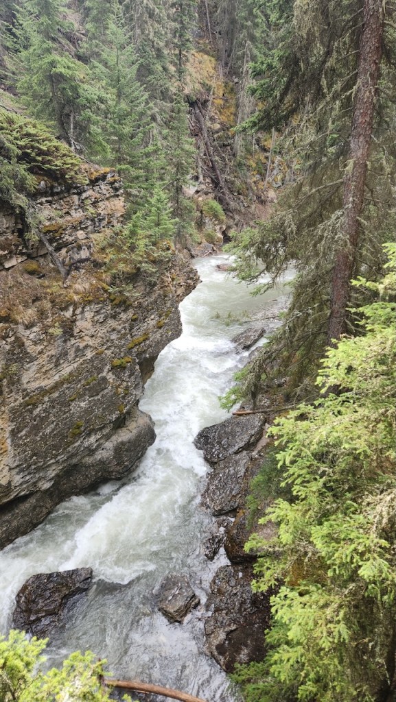
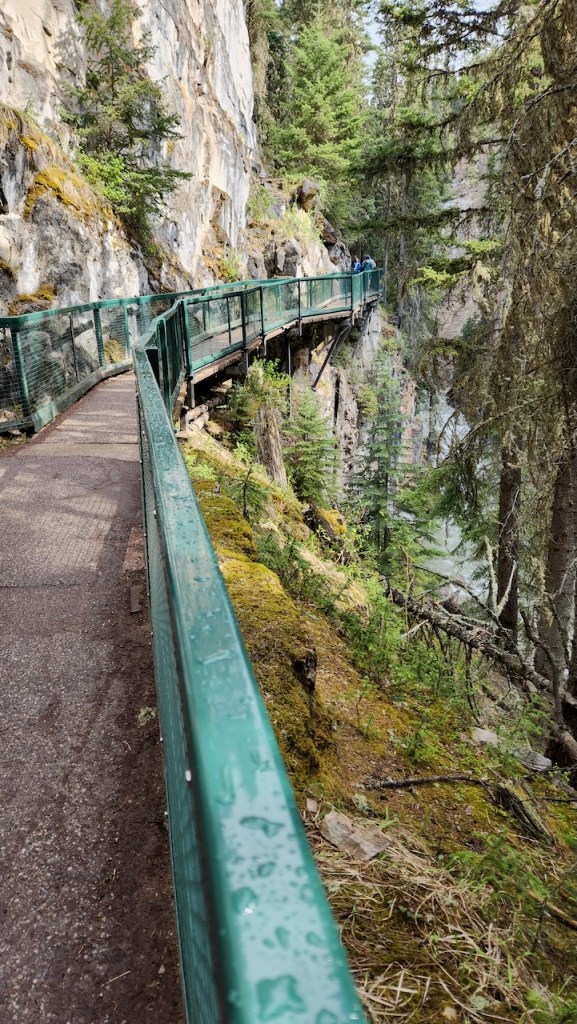
The Johnston Creek flows through the canyon, and at this time of year the snow melt has it pretty high. there are several stretches of the ~2-mile hike that go over these metal catwalks that hang on the cliffs and go right over the water.
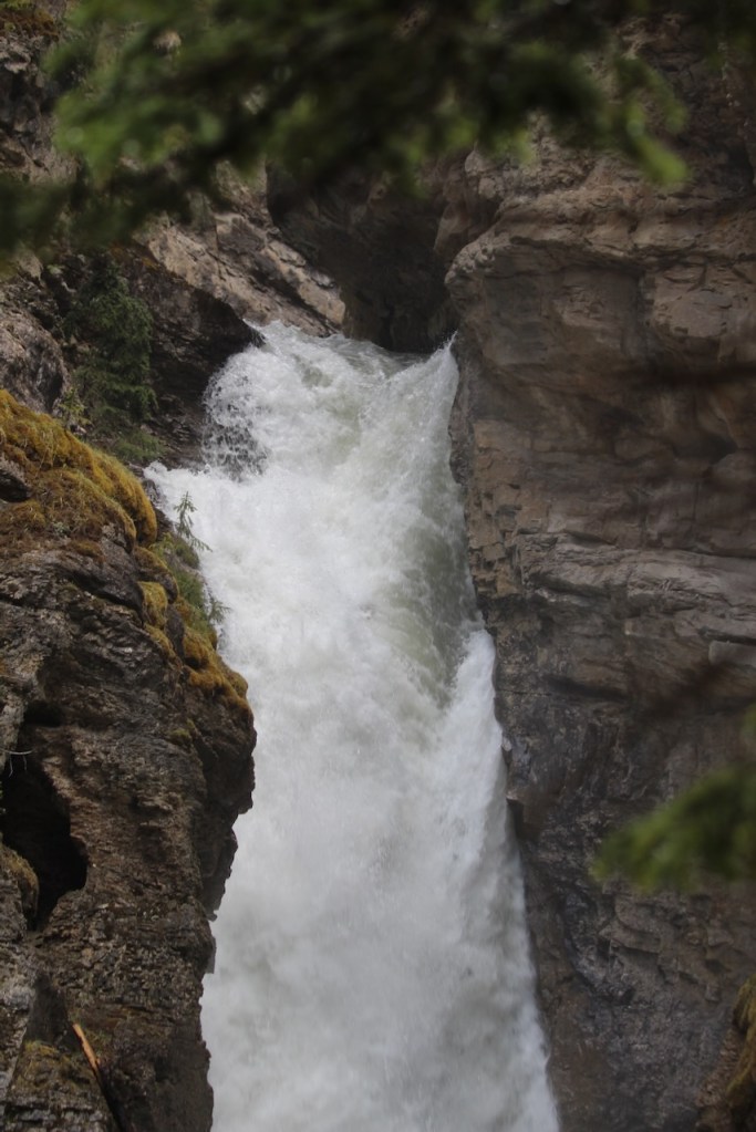
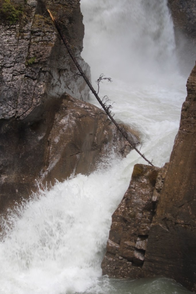
Pictures of us at the lower falls – there was a place to go through a cave and see behind the falls, but we were not inclined to wait in the line and end up getting wet. Our guide said that come June 1 – the start off the high tourist season – they would take this stop off their list because there would be too many people here to have it be an enjoyable walk – that whole catwalk would have been full of people shoulder to shoulder.
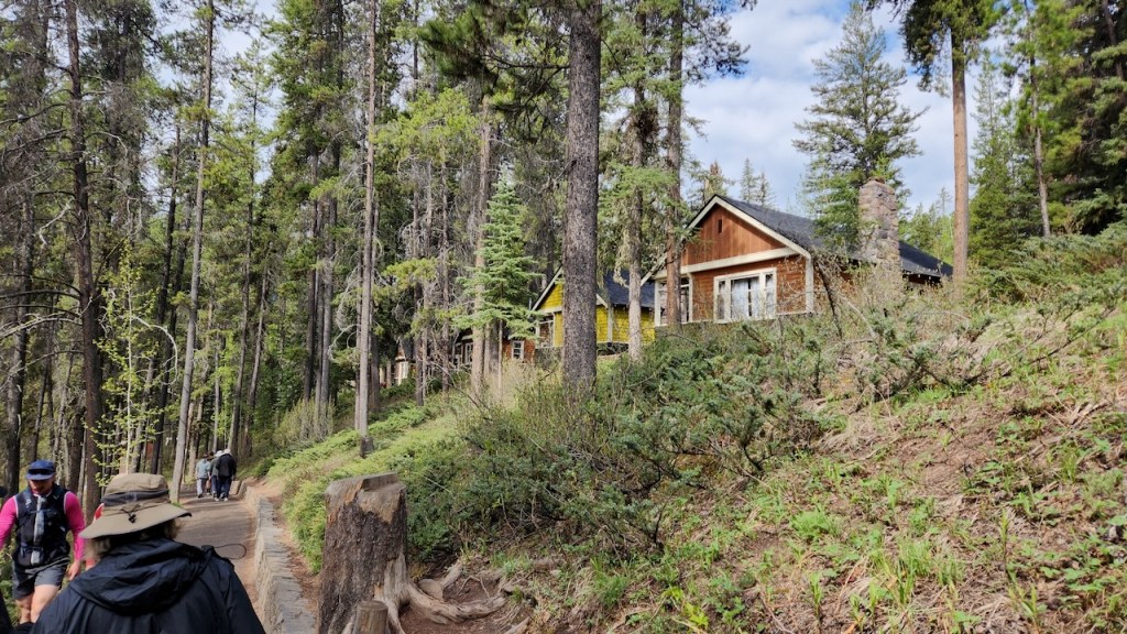
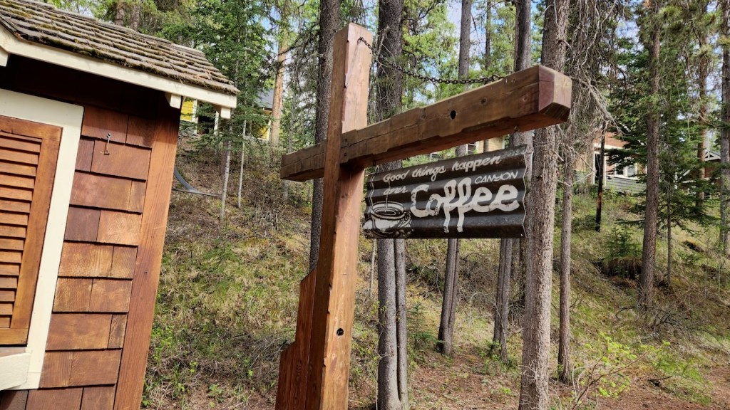
There are some cabins here that can be rented, and a place to get some refreshments – but even in late May, the line was too long for us to wait in.
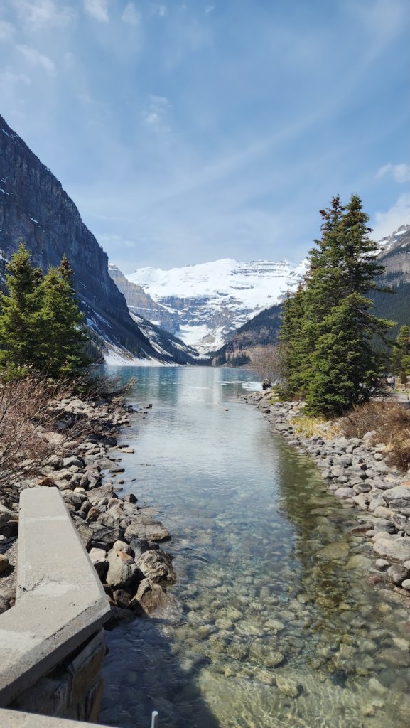
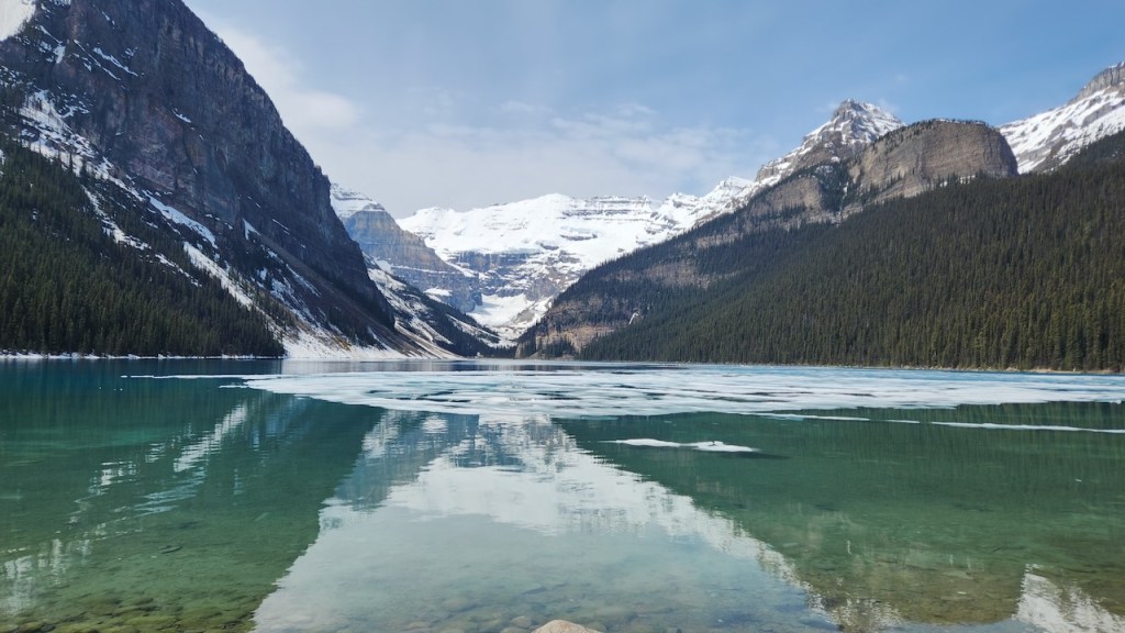
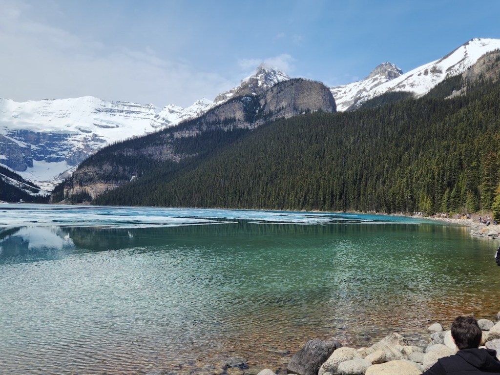
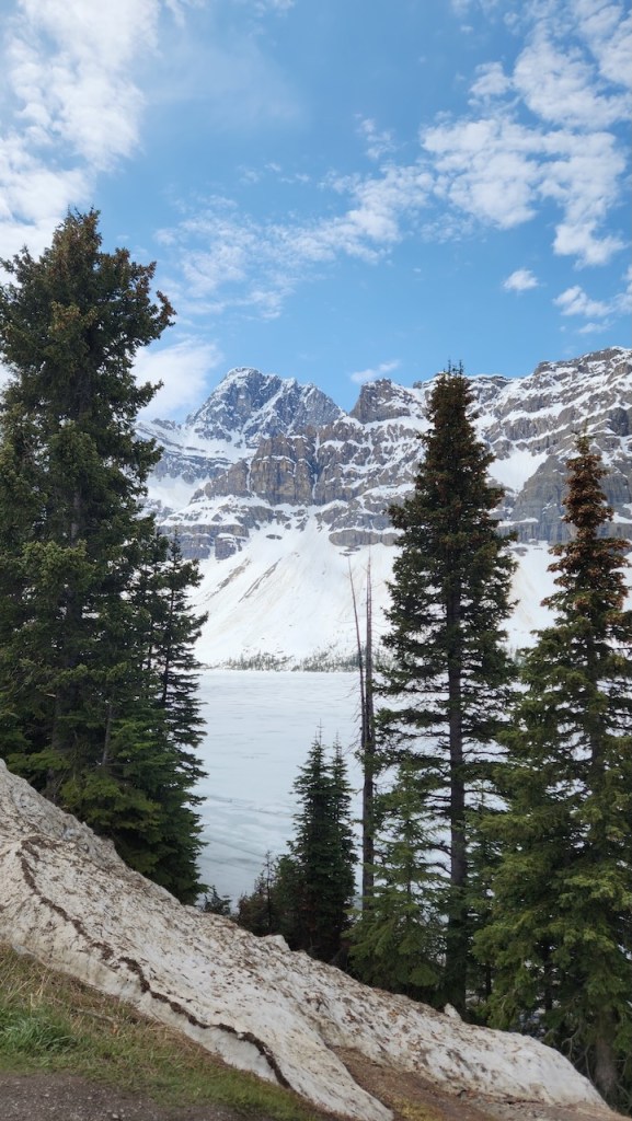
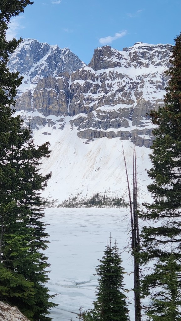
Our next stop was Lake Louise – one of the most visited spots in Canada! It is a glacial lake, and if you get it in the right light, you could see the blue color they talk about. It is the result of glacier flour – this is the microscopic silt that forms from the glacier grinding up rocks – and when it’s suspended in the lake it absorbs all but the blue-green light. There was still some ice on the lake.
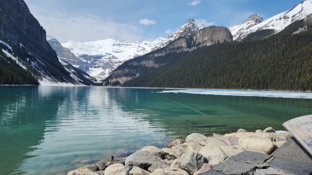
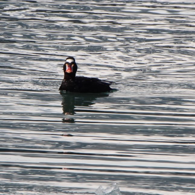
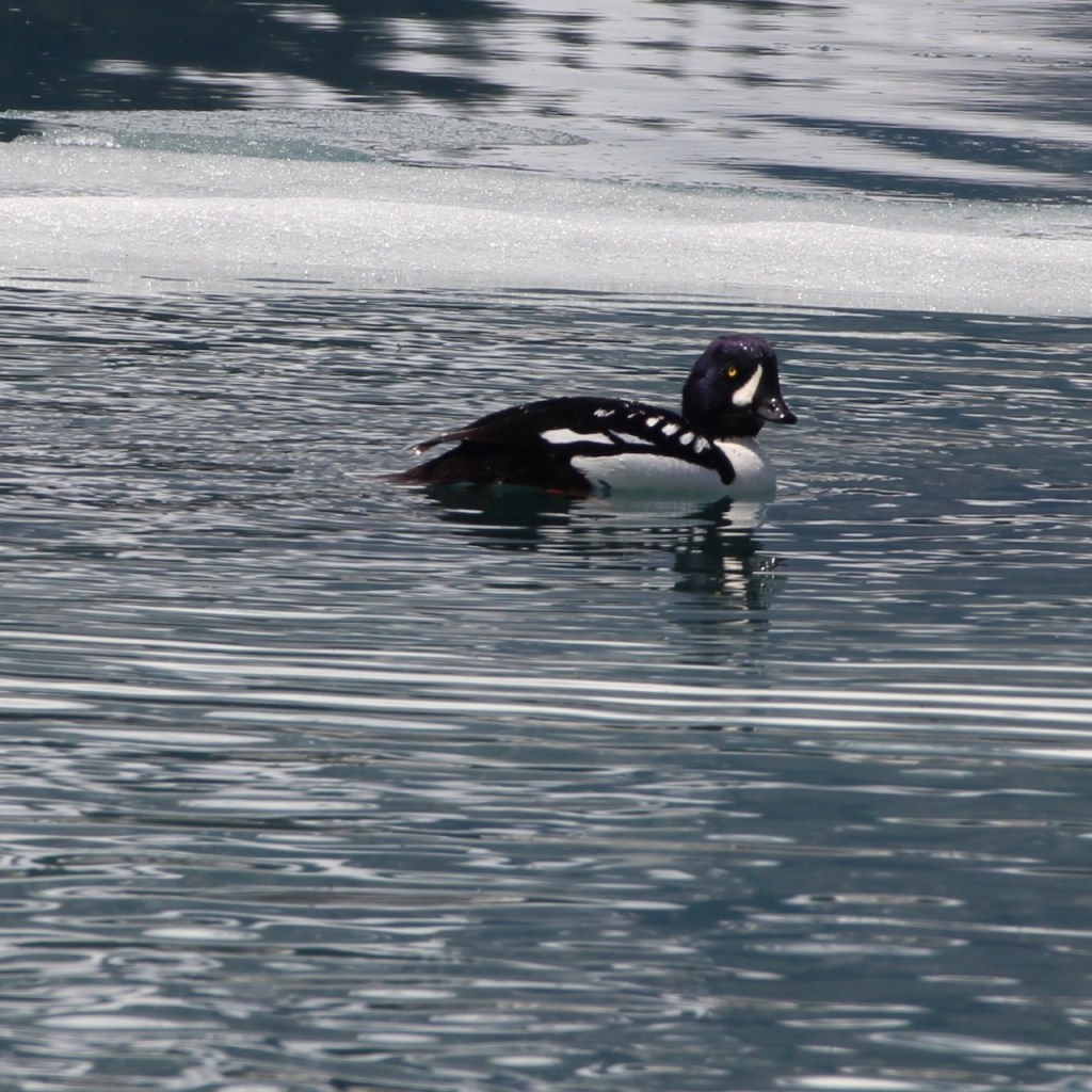
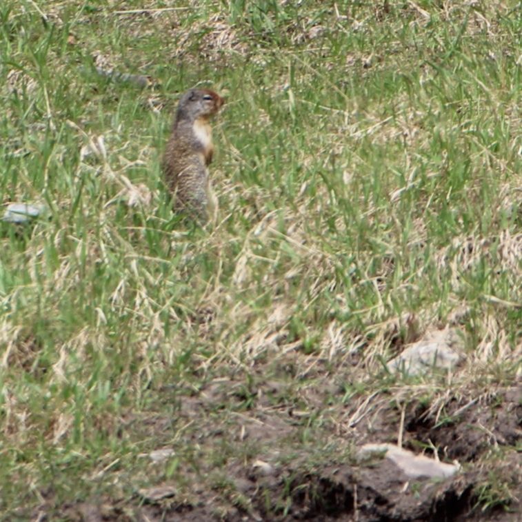
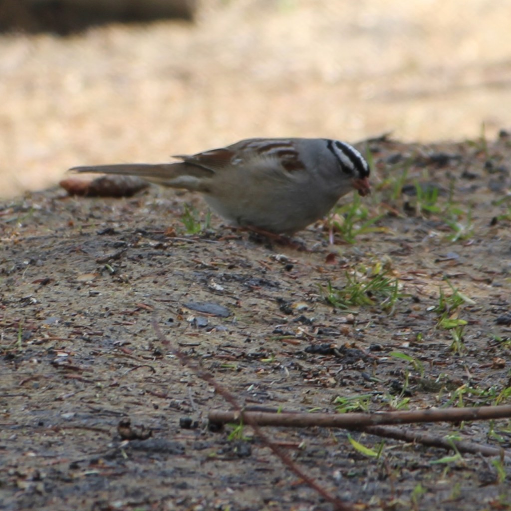
We saw a Surf Scoter and a Barrow’s Goldeneye on the lake. We thought it was a loon, but a passer-by told us it was a goldeneye. That’s a Columbian Ground Squirrel (not a prairie dog – just stands up the same way.) And a White-Crowned Sparrow was feeding on the ground.
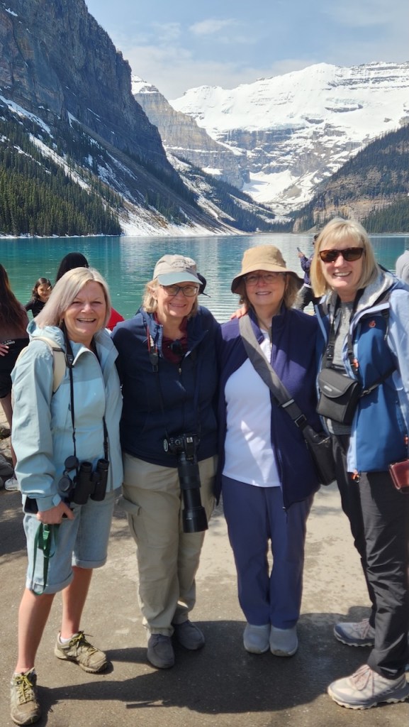
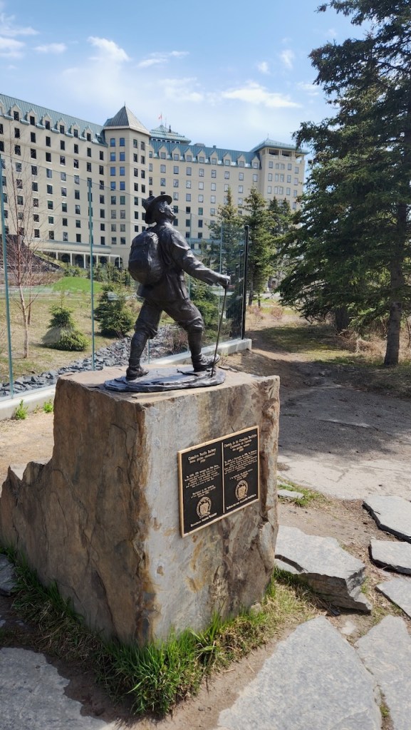
At Lake Louise we ran into some women we had seen at the gondola the prior day – we chatted with them there a couple of times and then again when we were at the lake – they were from England and were recently retired. That’s a statue dedicated to the Swiss Guides that were the original guides in the area.
The Fairmont Chateau Lake Louise, which began as a rail chalet in 1890, has certainly grown since then.
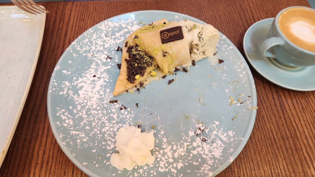
After Lake Louise, we headed back into Banff for lunch. We had brought PB&J’s for lunch and ate on the ride back to town, so we opted on getting dessert at the D-Spot. We split the Undercover Nut, which was pistachio ice cream wrapped in a crepe and with a side of chocolate sauce. It looked much better before I cut it in half.
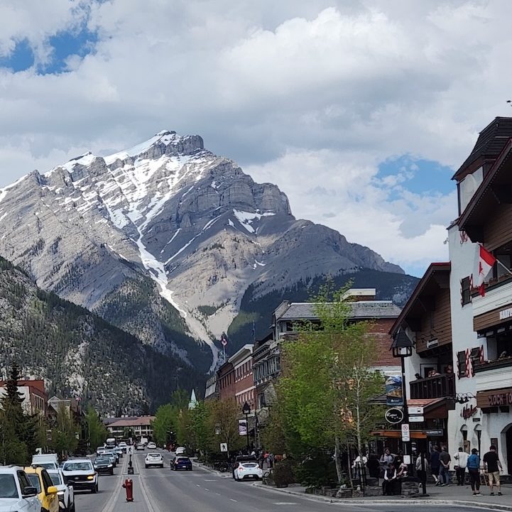
This is a classic shot of Cascade Mountain from the median strip of Banff Avenue..
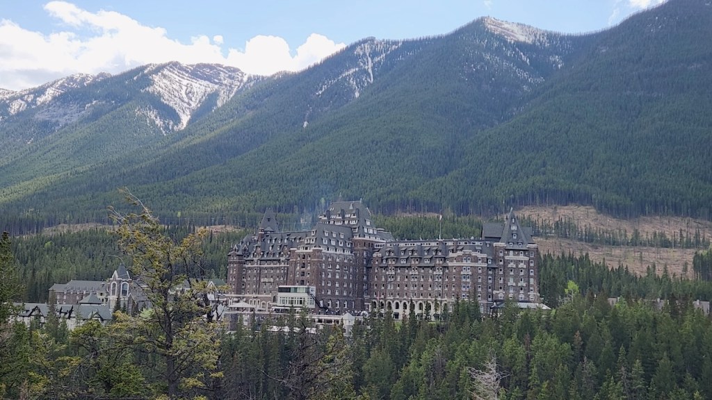
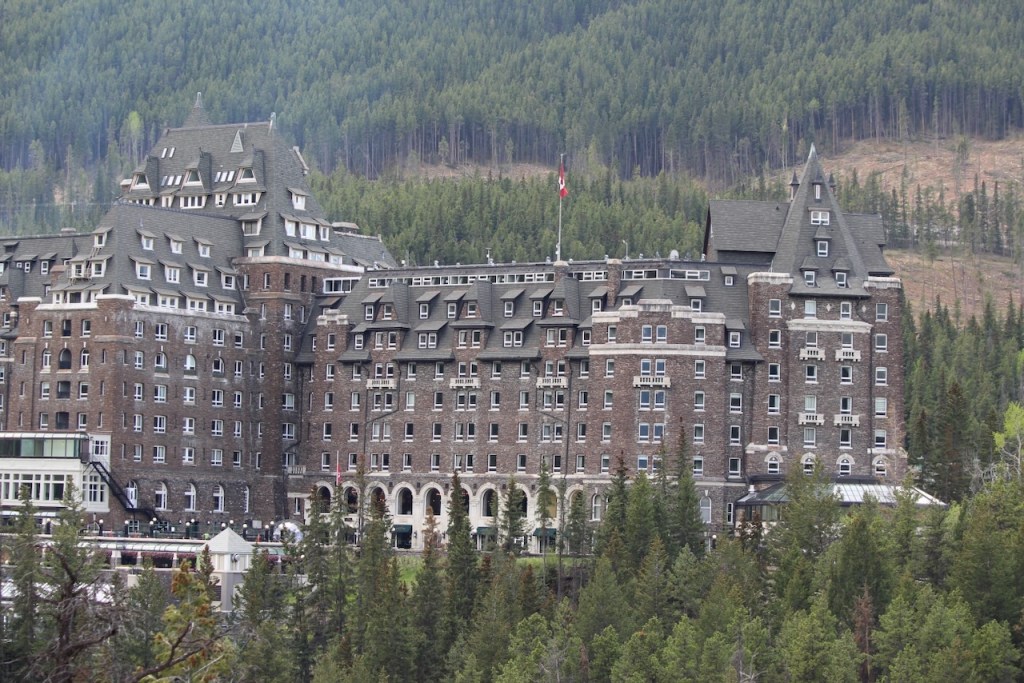
After lunch we went to a place called Surprise Corner – that’s because you get this great view of the Fairmont Banff Spring, also known as the Castle in the Rockies. It’s another of the hotels started in the late 1800’s when the railroad came through.
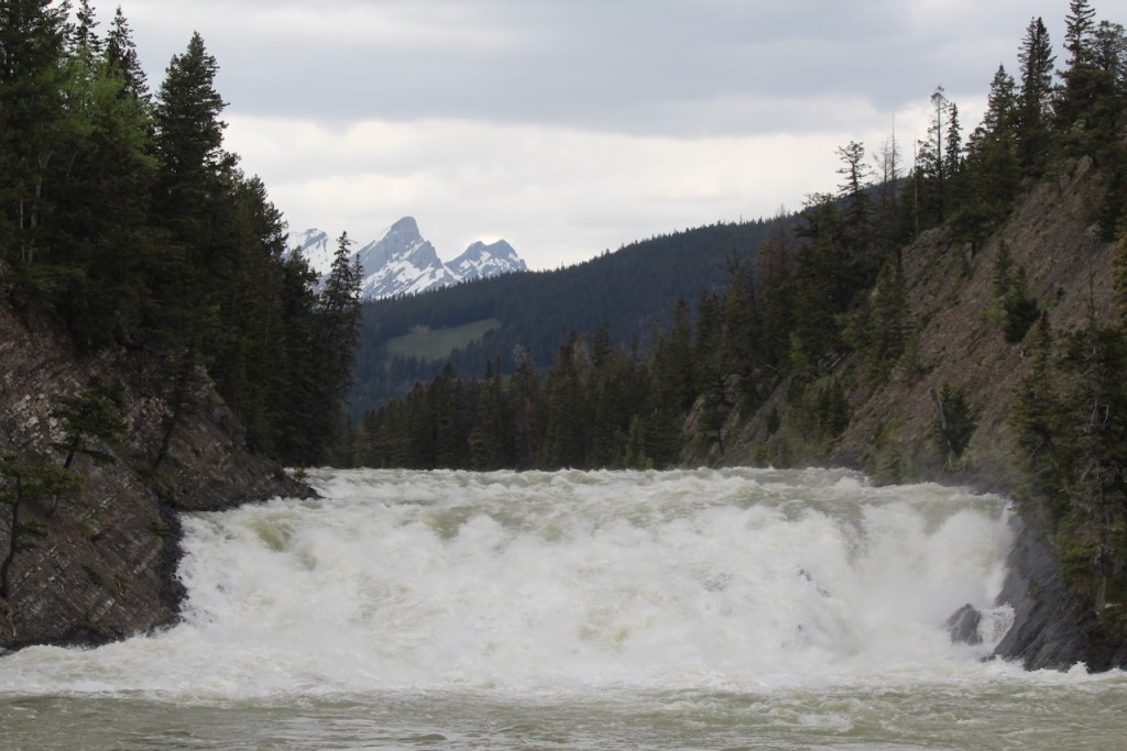
A view of the Bow Falls that makes them look less like rapids and more like a waterfall.
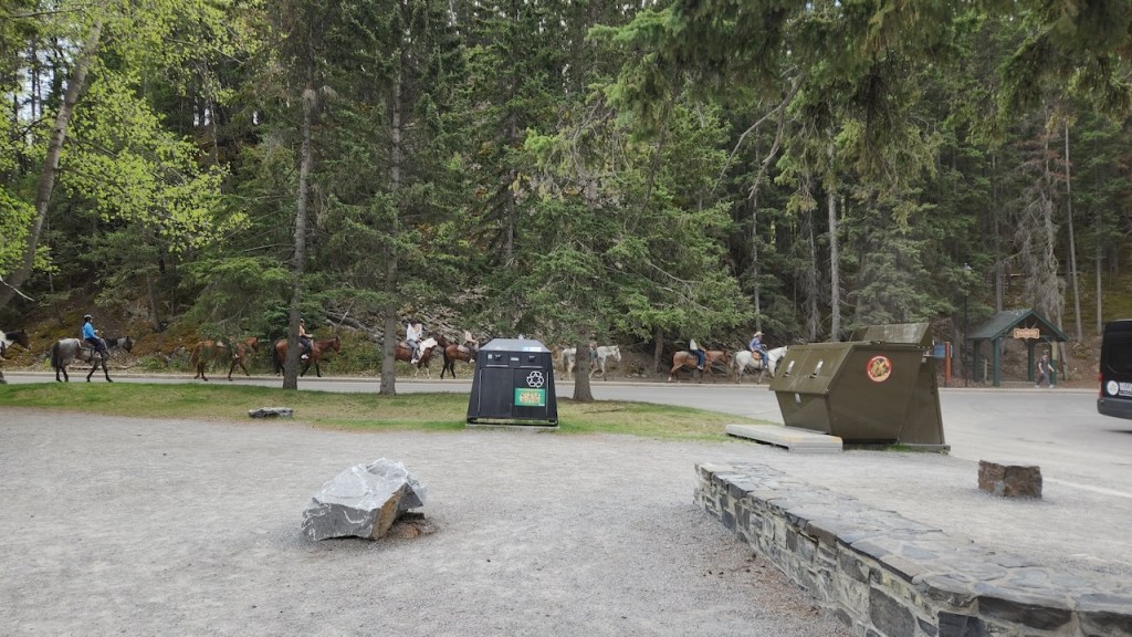
And when we were in the parking area, these horses went by.
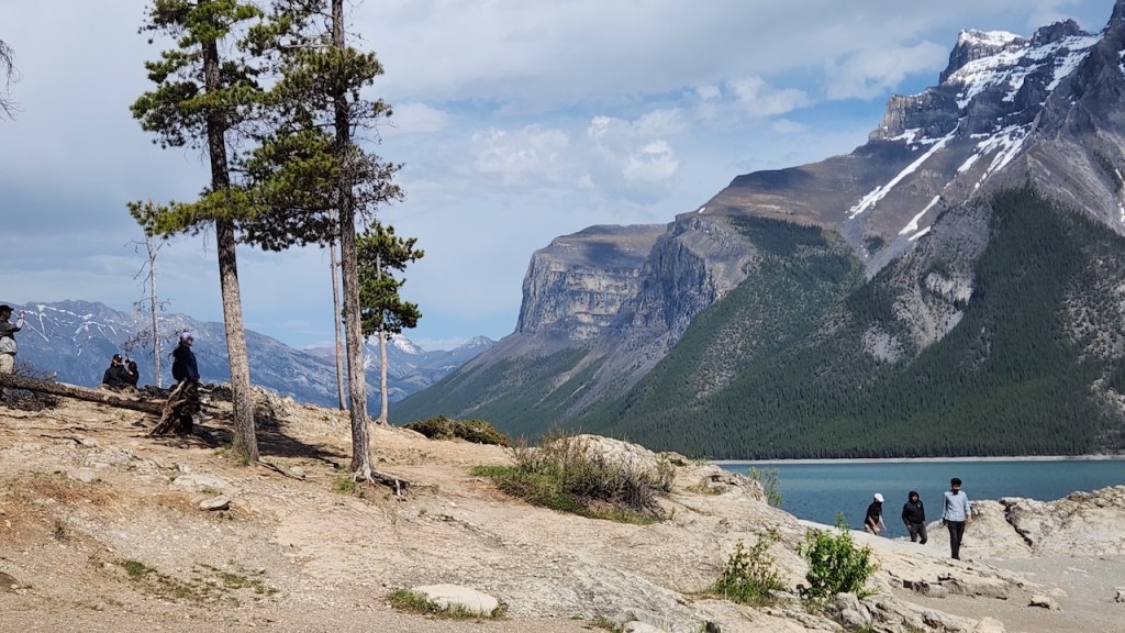
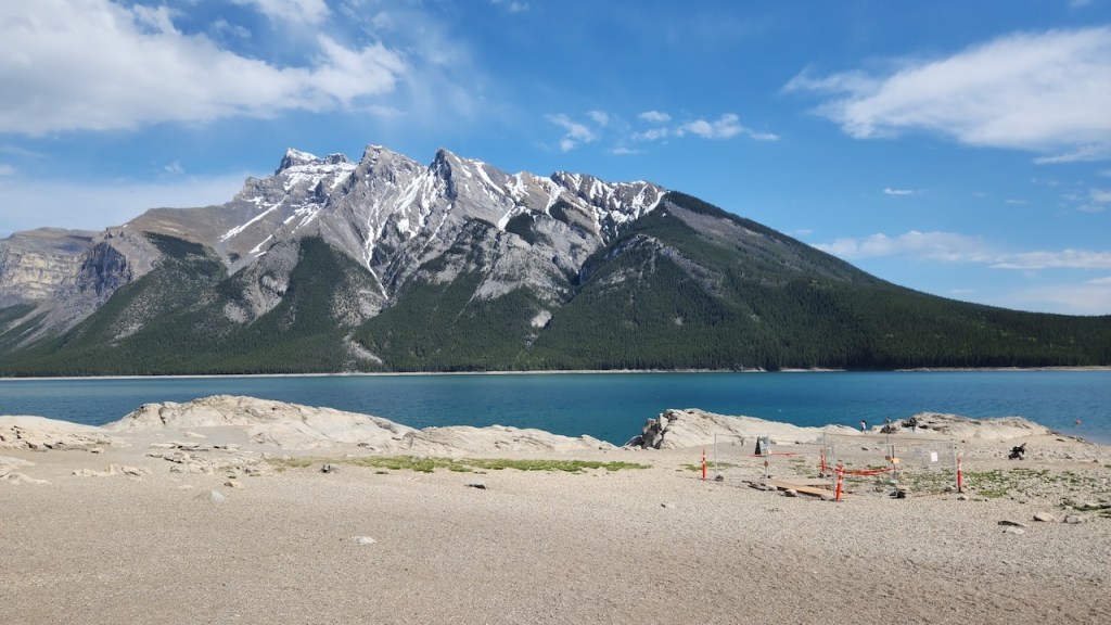
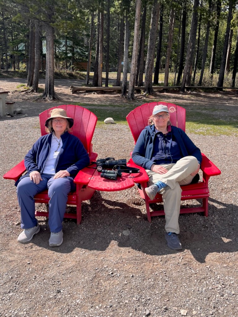
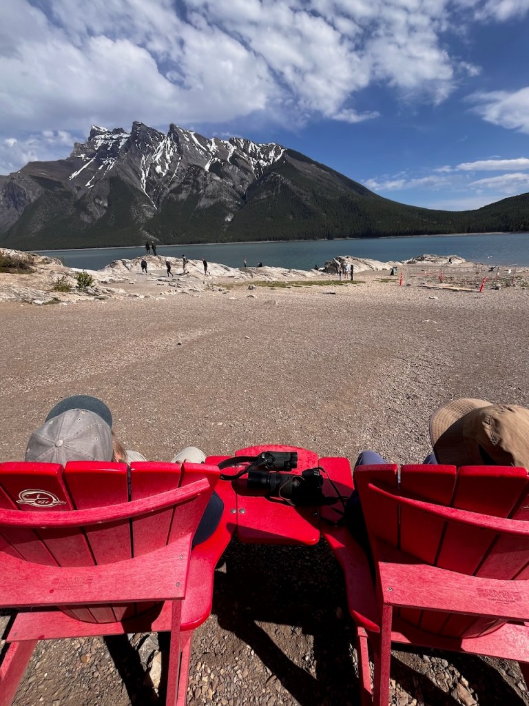
Our tour then took us back to Lake Minnewanka – this time we got out and walked around. We found the Red Chairs – which are a fixture at National Parks in Canada, and our guide snapped a couple of pictures of us relaxing and enjoying the view of Mount Rundell.
And the elk was back resting when we got back to the campground.
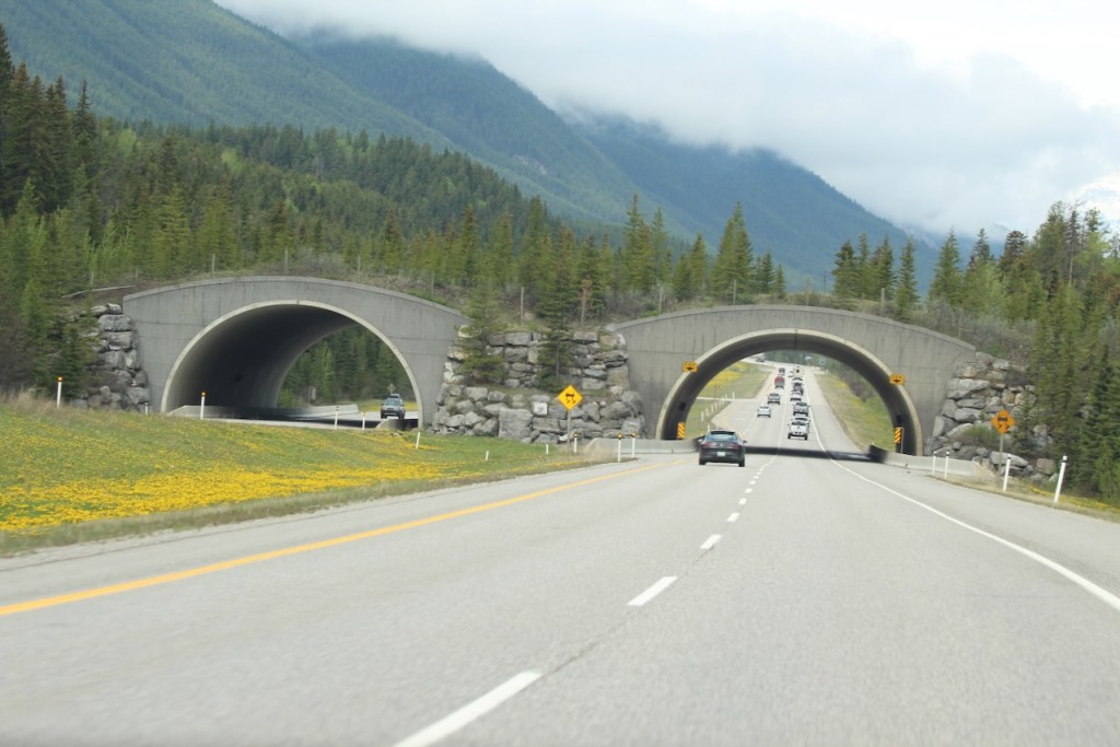
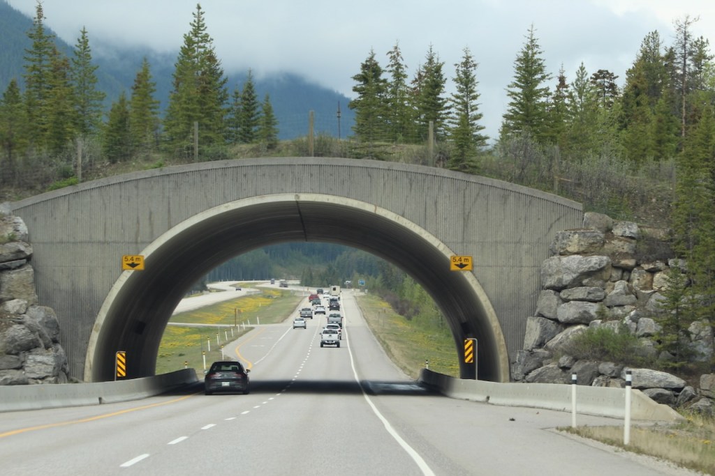
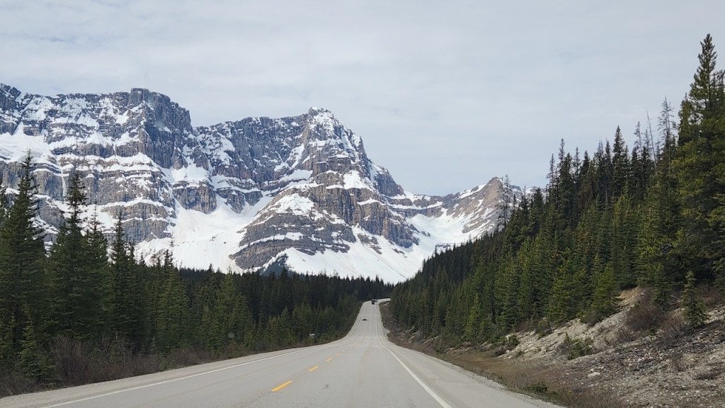
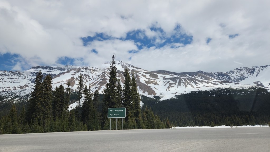
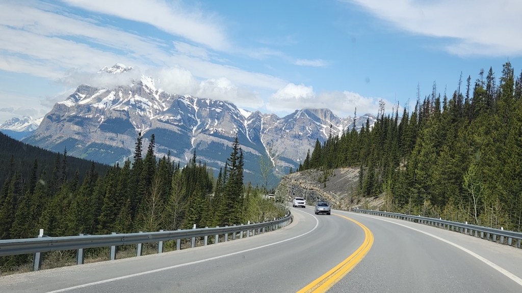
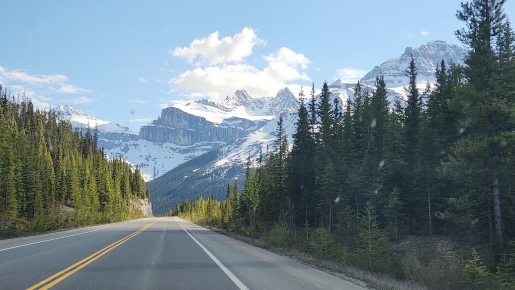
On Wednesday, May 27th, we drove the Icefields Parkway – that’s the road between Banff and Jasper. But first a comment on Trans Canada Highway 1 – it goes right through Banff National Park for 51 miles and has 38 underpasses and 6 overpasses just for wildlife. They were installed between 1981 and 2014, as the road was upgraded from two lane to four lane. There is fencing along the entire highway which guides the animals to the overpasses. Not only has this cut “wildlife-vehicle collisions” by 80%, it has helped the genetic diversity of the wildlife population. And they raised the speed limit from 70 k/hr to 90 (that’s like 45 m/hr to 55.) Also, all of the intersections, there really aren’t that many – maybe 10, have cattle guards to try to keep the bigger animals from getting onto the wrong side of the fence.
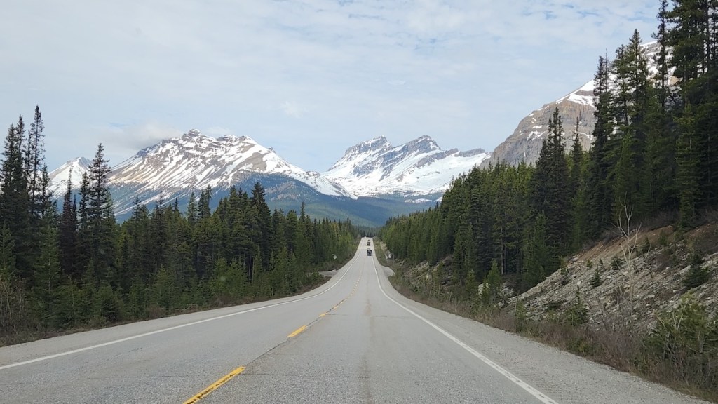
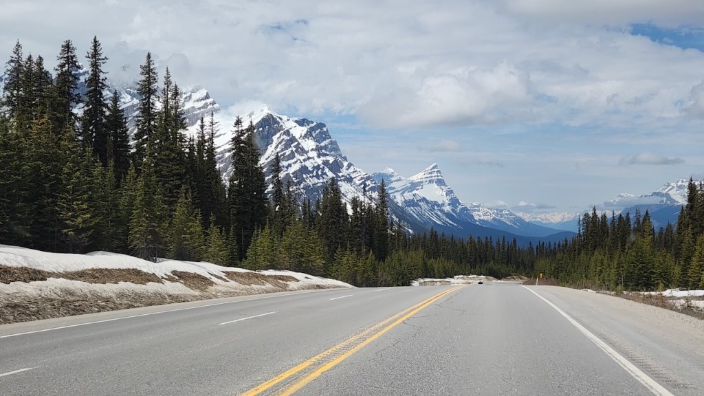
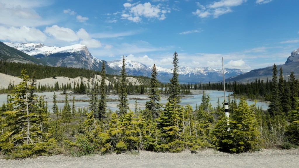
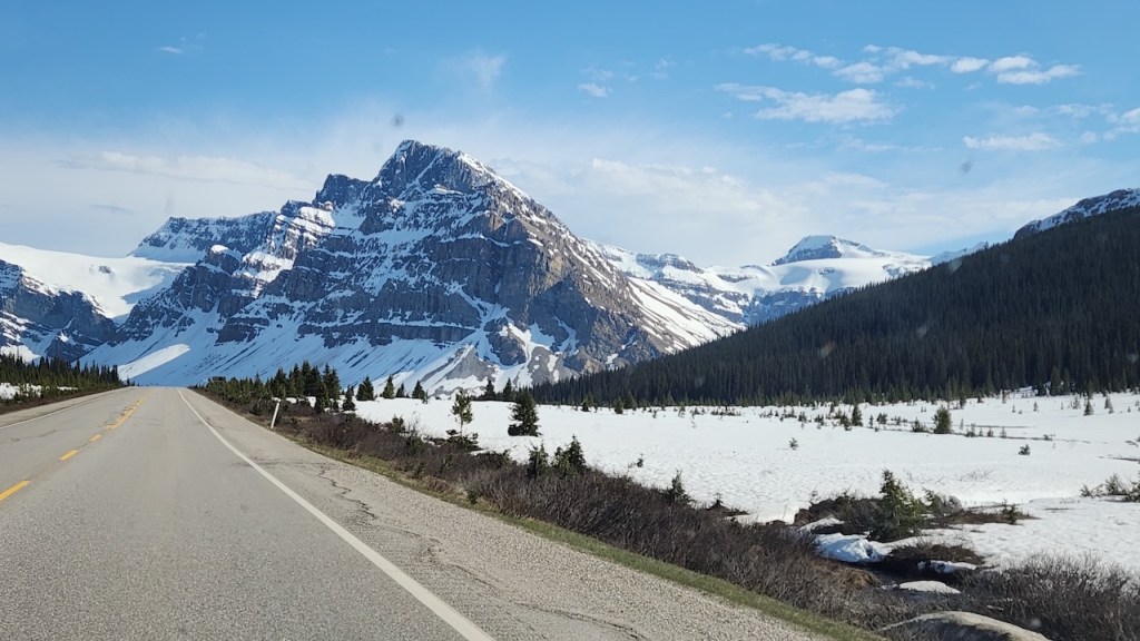
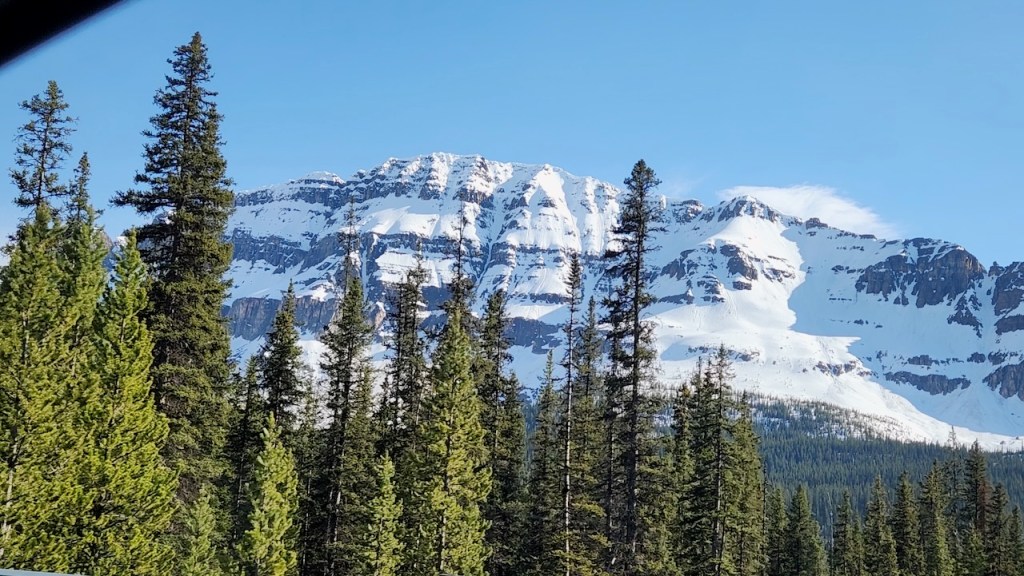
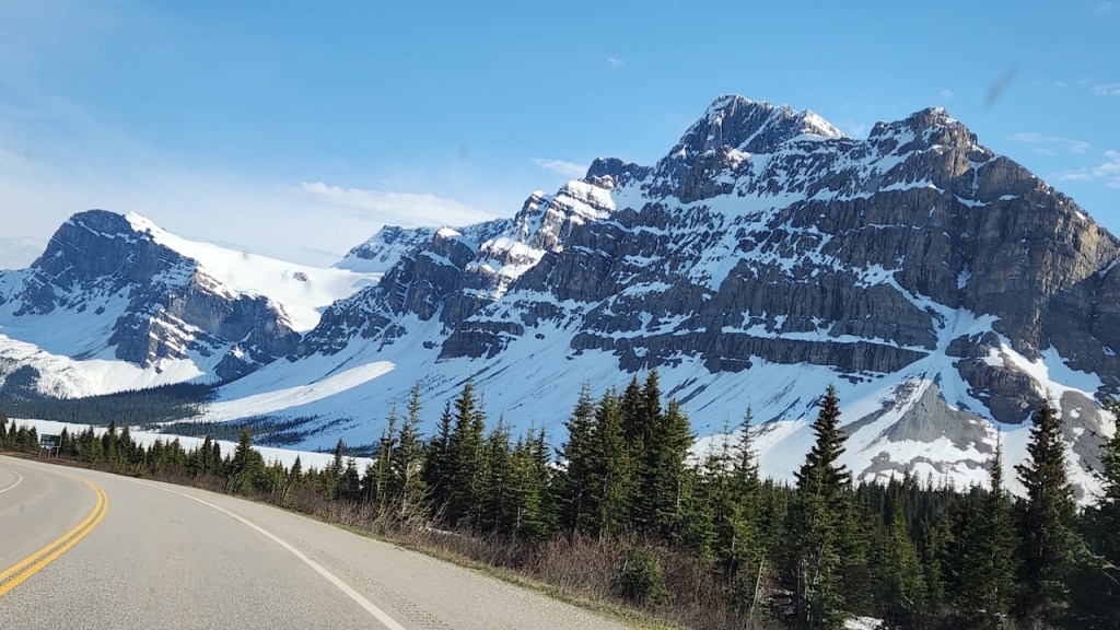
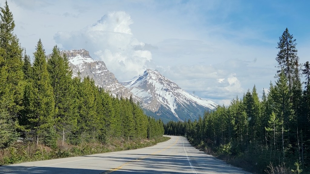
Some of the sites along the parkway.
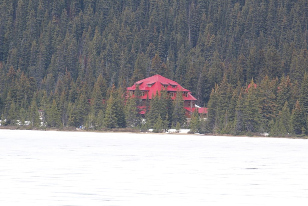
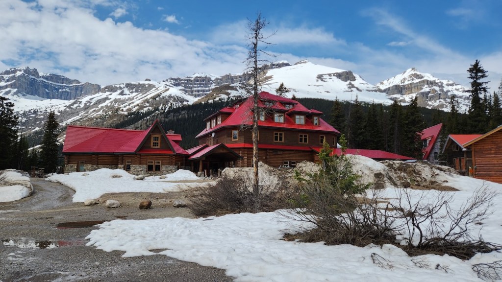
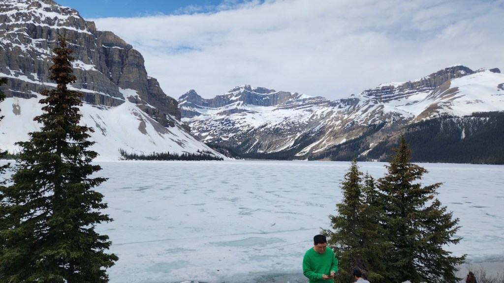
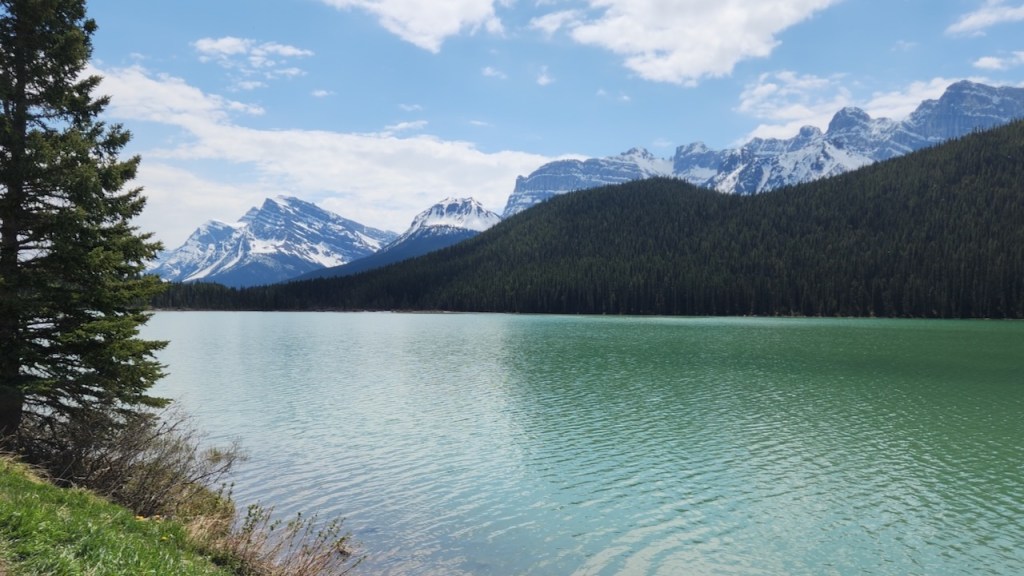
Here we are at the edge of Bow Lake — it was still totally iced in. And what is now the Lodge at Bow Lake was started as a shack in the 1920’s by Jimmy Simpson, one of the original guides in the area. It turned into a hotel in the 30’s and has recently reopened after closing during Covid.
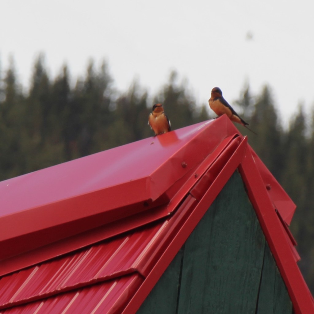
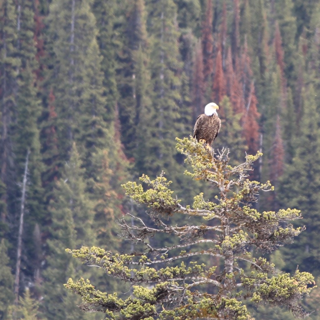
Caught these barn swallows and an eagle while at the Lodge at Bow Lake.
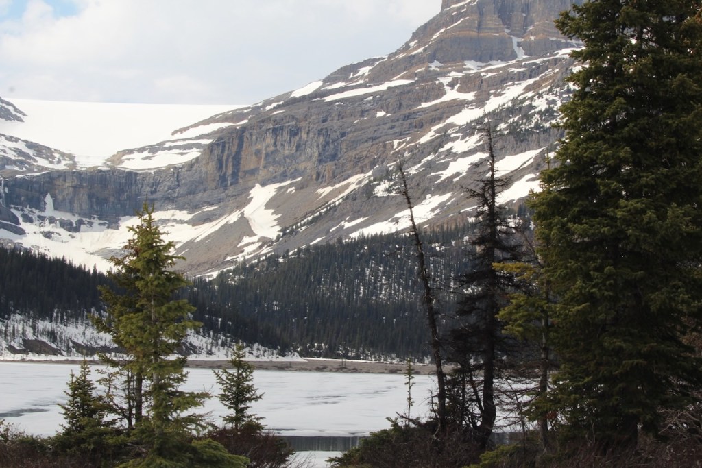
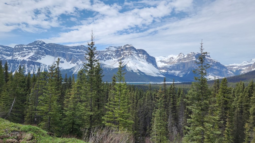
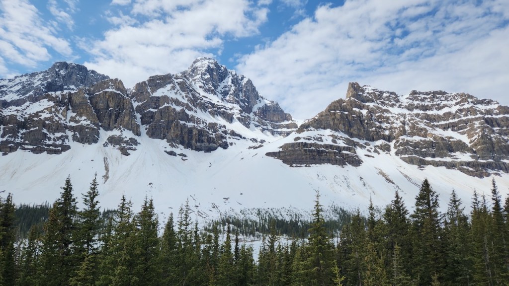
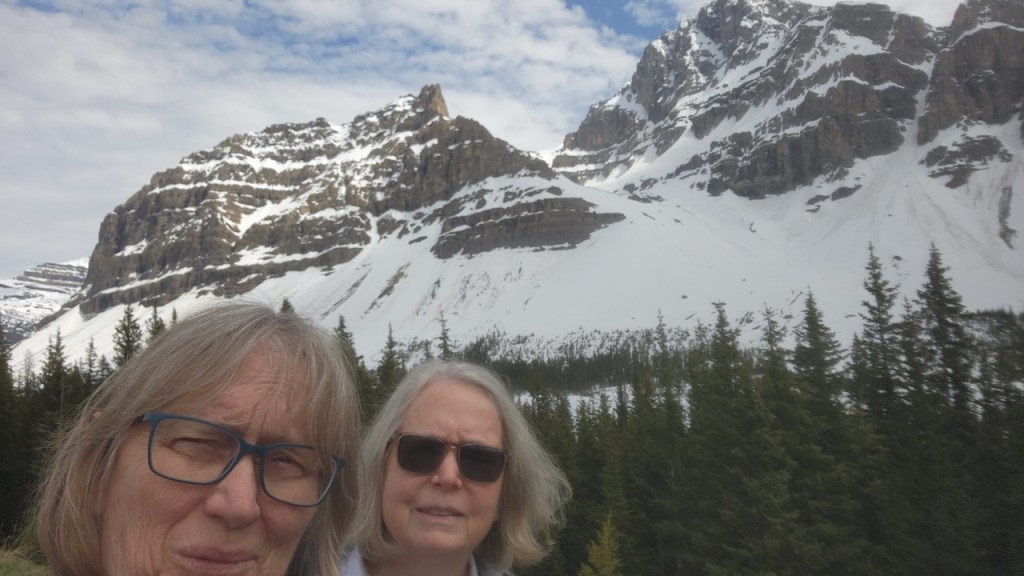
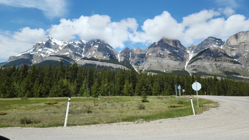
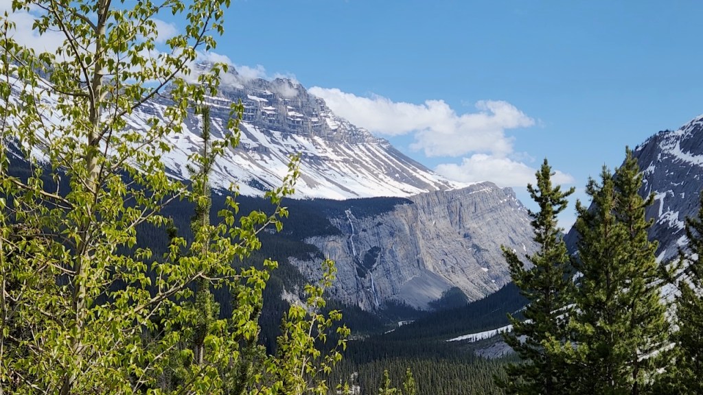
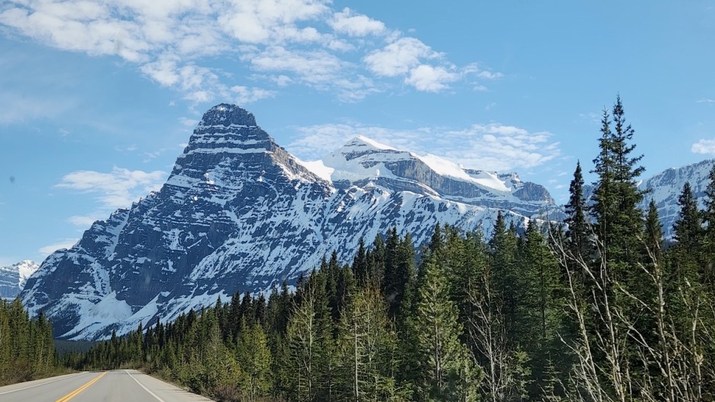
Views along the parkway – it was just amazing to drive through this area.
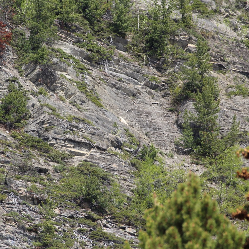
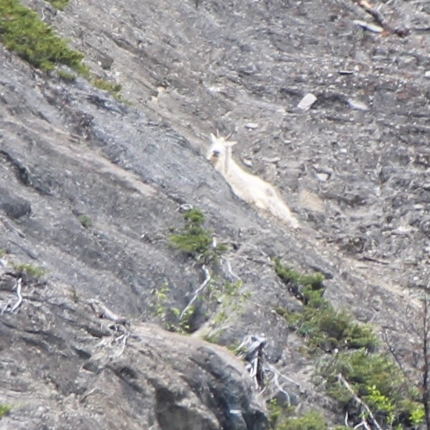
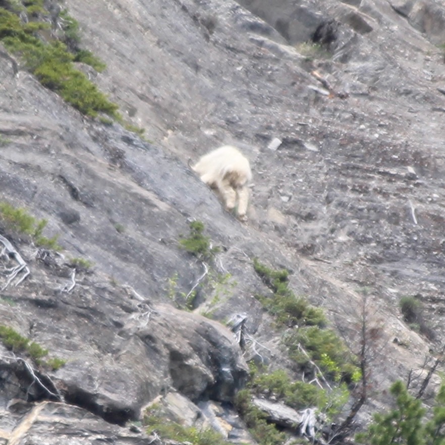
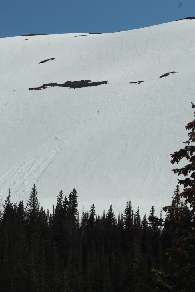
Do you see that patch of snow in the middle of this photo?
Well, because we were in a parking lot, we found out it was actually a Mountain Goat! Here are some pictures with the telephoto on high.
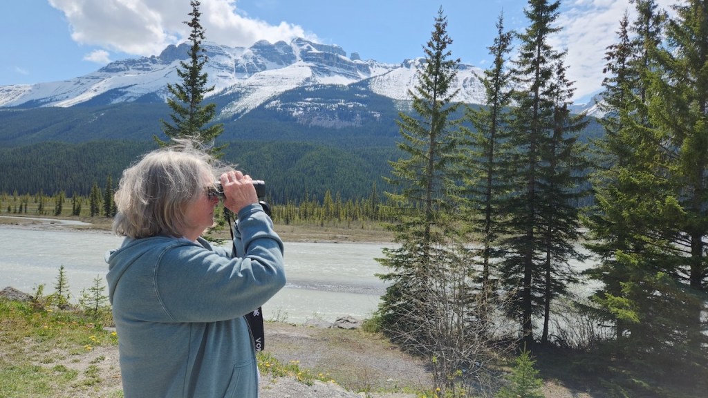
This is the North Saskatchewan River, running along the parkway.
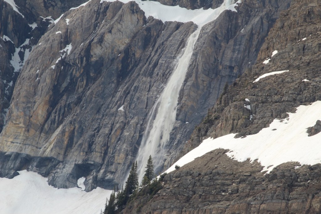
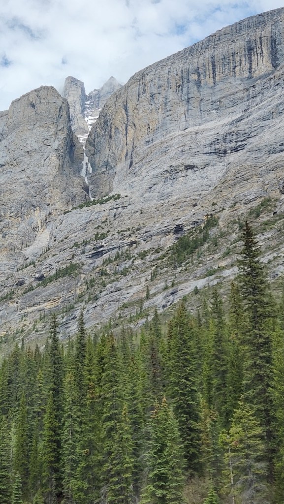
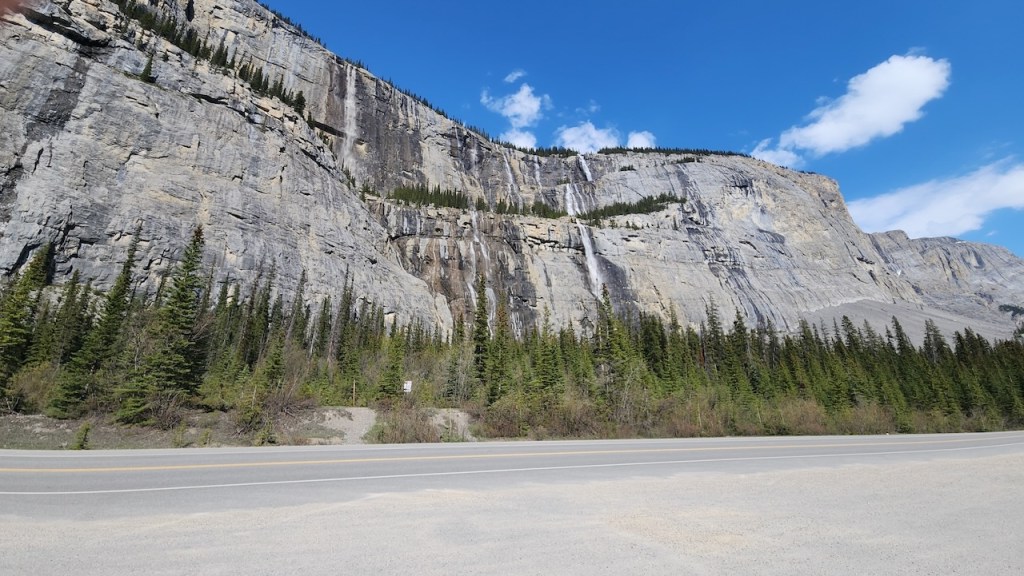
Another waterfall, and it looked like skies had come down this mountain.
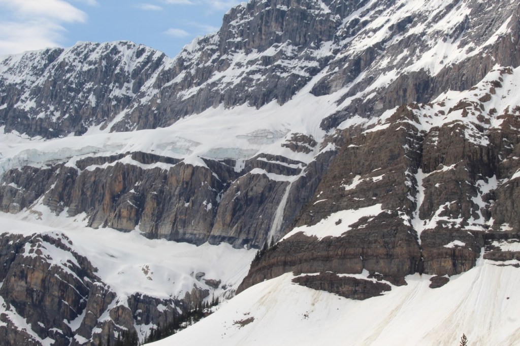
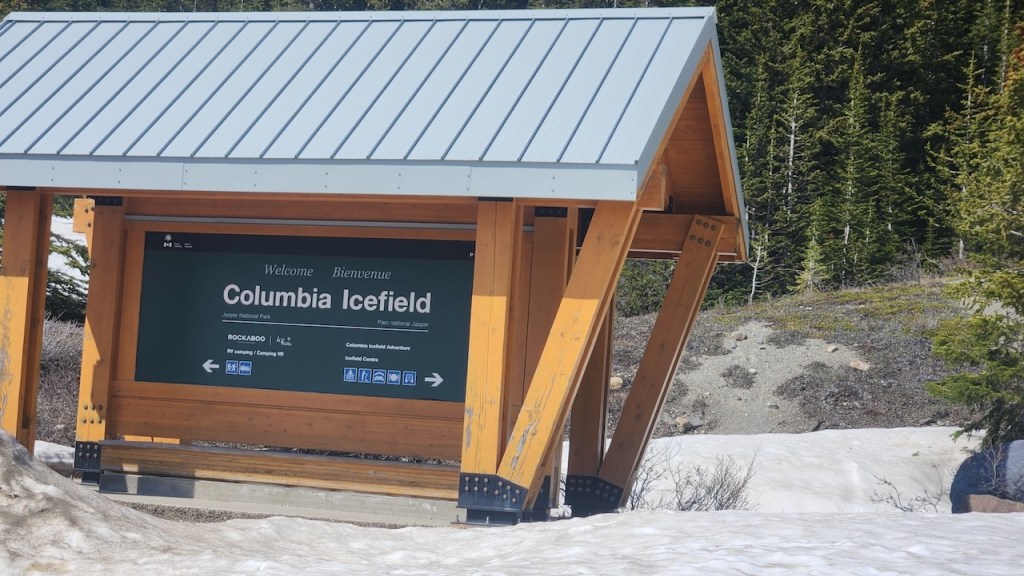
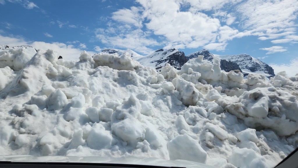
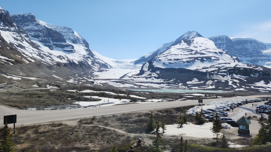
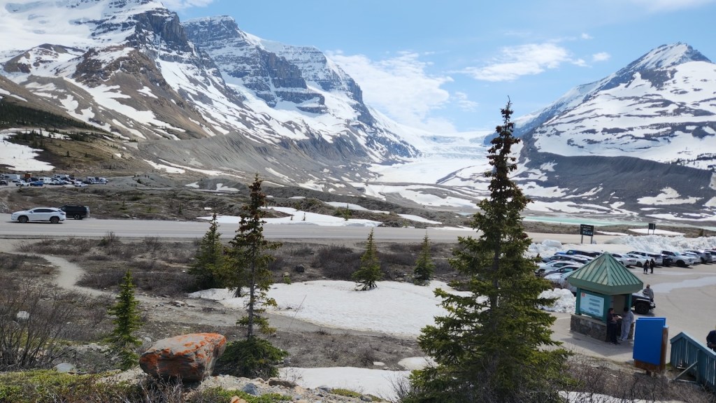
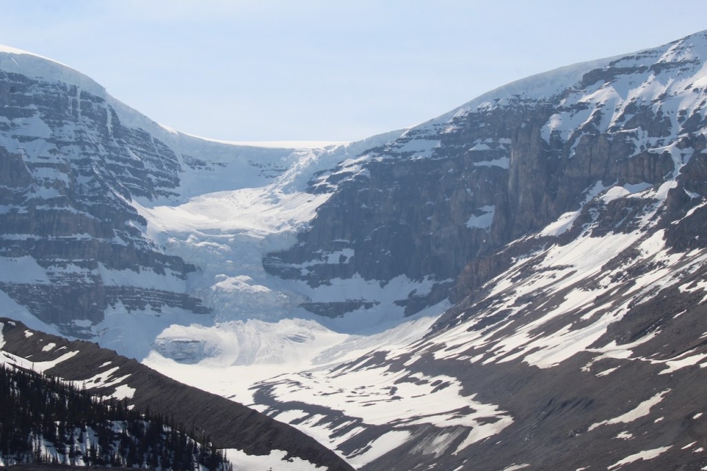
Then we made it to the Columbia Icefield. The Columbia Icefield is the largest icefield in the Rockies and currently spans over 47k acres. Its meltwater flows to three oceans – Pacific, Arctic, and Atlantic – making it one of North America’s most important freshwater sources. That’s the pile of snow that was in front of our parking space.
You can’t see much of the icefield, though you can see in the photo below the layer of ice on the mountain to the right in the photo below – that’s the edge of the icefield.. The Athabasca glacier is in the middle of the photo. It was explained that the ice field is like a lake, and the glacier is the stream that flows out of it.
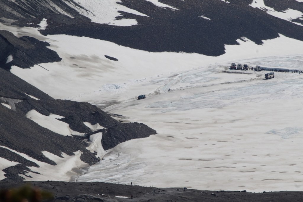
In the photo below, I zoomed in on the lower left of the glacier – you can see the folks who got there early enough to go out and walk on the glacier.
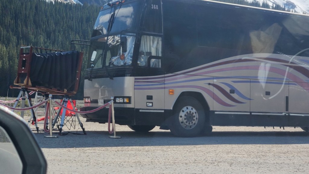
We did not go further north than the ice fields – it would have added another four hours to drive up to Jasper, and it was already nearly 5 pm and we had at least 2 hours to get back to the campground. So here are some shots from driving back to the RV. We stopped when we saw some folks working this camera in one of the turn outs. Think they were taking a photo of the waterfall across the road. They looked to be Japanese and didn’t speak English, but although I think it was a 20 x 24 camera, it didn’t seem to be a Polaroid.
The last few pics from the Ice Fields Parkway
And once more the elk was in the campground.
And that was the end of our adventures in Banff.
Next up, one more Legislative Building.
Until then, safe travels!

Leave a comment